Runic rock inscription U870, L1943:4725 in Gryta parish, Enköping municipality
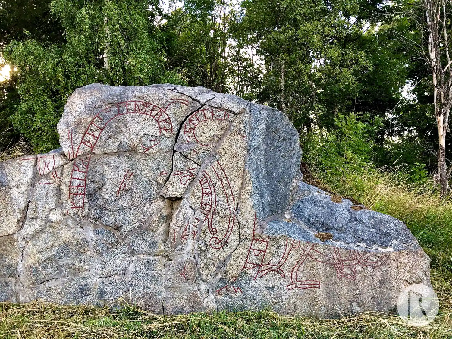
Photo: Niklas Vackerdag
Runic inscription
... ...k : onek[R :] (þ)ai[R] (l)itu : marka : stain : þ[insa : at rok br]oþu[r :] (s)[en] ... ...(þ)biarn : hiu
Inscription
... ...k : onek[R :] (þ)ai[R] (l)itu : marka : stain : þ[insa : at rok br]oþu[r :] (s)[en] ... ...(þ)biarn : hiu
Translation
... and Óhneigr(?), they had this stone marked in memory of Hrókr, their brother ... Auðbjôrn(?)/Viðbjôrn(?) cut.
Find the carving
Runic rock inscription U870, L1943:4725 in Gryta parish, Enköping municipality
Facts
| Monument number | L1943:4725 |
|---|---|
| Swedish National Heritage Board ID | Gryta 2:1 |
| Carver | Ödbjörn (S); Vidbjörn (S) [Stille 1999b:139] |
| Status | Confirmed on location |
| Place | Visible above ground |
| Material | Fine-crystalline granite |
| Period | Viking age |
| Antiquarian assessment | Ancient monument |
| Damage status | Damage |
| County | Uppsala |
| Municipality | Enköping |
| Parish | Gryta |
| Coordinates | 59.767558333333, 17.388321666667 |
Sources
Most of the factual information in Runkartan comes from the Swedish National Heritage Board’s Fornsök data and from the Scandinavian Runic Text Database. The maps come from OpenStreetMap and Leaflet.js. The photographs were taken by the credited photographers.