Rune-stone Kvinnebyamuletten, Öl43 - ÖlFv1972;268, L1958:4407 in Gärdslösa parish, Borgholm municipality
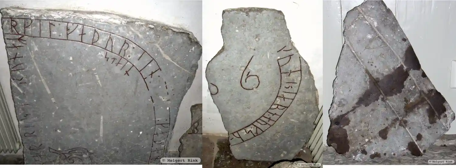
Photo: Melgert Rink
Runic inscription
kunbiarn : auk : su-… … uk : [i(o)(h)]… … …rgil : faþur : sin : … : goþan : g… …tuar ris(t)[(i)] : runaʀ … stain …
Inscription
kunbiarn : auk : su-… … uk : [i(o)(h)]… … …rgil : faþur : sin : … : goþan : g… …tuar ris(t)[(i)] : runaʀ … stain …
Translation
Gunnbjǫrn and Sveinn … and Jóhan … Þorkell(?), their very(?) good father, … Oddvarr(?) carved the runes … stone …
Find the carving
Rune-stone Kvinnebyamuletten, Öl43 - ÖlFv1972;268, L1958:4407 in Gärdslösa parish, Borgholm municipality
Facts
| Monument number | L1958:4407 |
|---|---|
| Swedish National Heritage Board ID | Gärdslösa 79:1 |
| Status | Confirmed on location |
| Place | Visible above ground |
| Antiquarian assessment | Ancient monument |
| Damage status | Damage |
| County | Kalmar |
| Municipality | Borgholm |
| Parish | Gärdslösa |
| Coordinates | 56.7935085, 16.7373685 |
Sources
Most of the factual information in Runkartan comes from the Swedish National Heritage Board’s Fornsök data and from the Scandinavian Runic Text Database. The maps come from OpenStreetMap and Leaflet.js. The photographs were taken by the credited photographers.