Rune-stone Ög94, L2010:9415 in Väderstad parish, Mjölby municipality
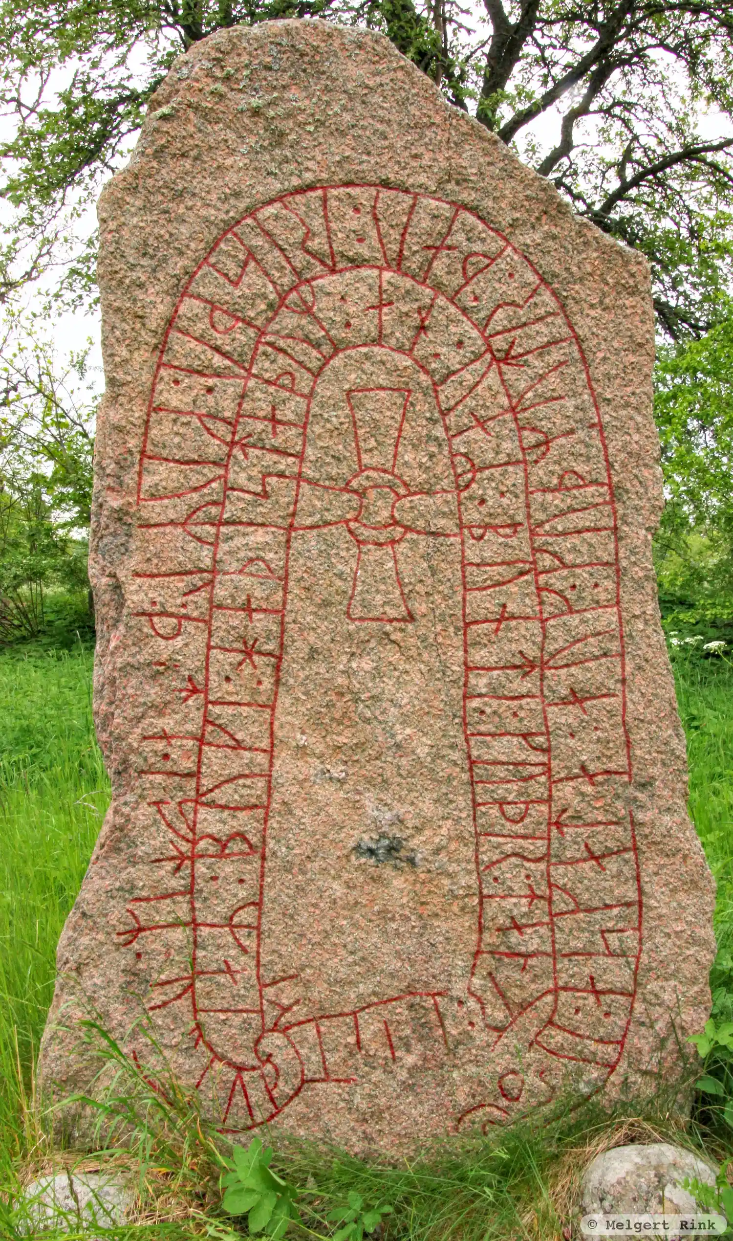
Photo: Melgert Rink
Runic inscription
: askata : auk : kuþmutr : þau : risþu : kuml : þ[i](t)a : iftiR : u-auk : iaR : buki| |i : haþistaþum : an : uaR : bunti : kuþr : taþr : i : ki[(r)]k[(i)(u)(m)]
Inscription
: askata : auk : kuþmutr : þau : risþu : kuml : þ[i](t)a : iftiR : u-auk : iaR : buki| |i : haþistaþum : an : uaR : bunti : kuþr : taþr : i : ki[(r)]k[(i)(u)(m)]
Translation
Ásgauta/Áskatla and Guðmundr, they raised this monument in memory of Oddlaugr(?), who lived in Haðistaðir. He was a good husbandman; (he) died in Greece(?)
Find the carving
Rune-stone Ög94, L2010:9415 in Väderstad parish, Mjölby municipality
Facts
| Monument number | L2010:9415 |
|---|---|
| Swedish National Heritage Board ID | Väderstad 78:3 |
| Status | Confirmed on location |
| Place | Visible above ground |
| Material | Reddish granite |
| Antiquarian assessment | Ancient monument |
| Damage status | Undamaged |
| County | Östergötland |
| Municipality | Mjölby |
| Parish | Väderstad |
| Coordinates | 58.3102455, 14.9113255 |
Sources
Most of the factual information in Runkartan comes from the Swedish National Heritage Board’s Fornsök data and from the Scandinavian Runic Text Database. The maps come from OpenStreetMap and Leaflet.js. The photographs were taken by the credited photographers.