Rune-stone Sö333, L1983:7517 in Åker parish, Strängnäs municipality
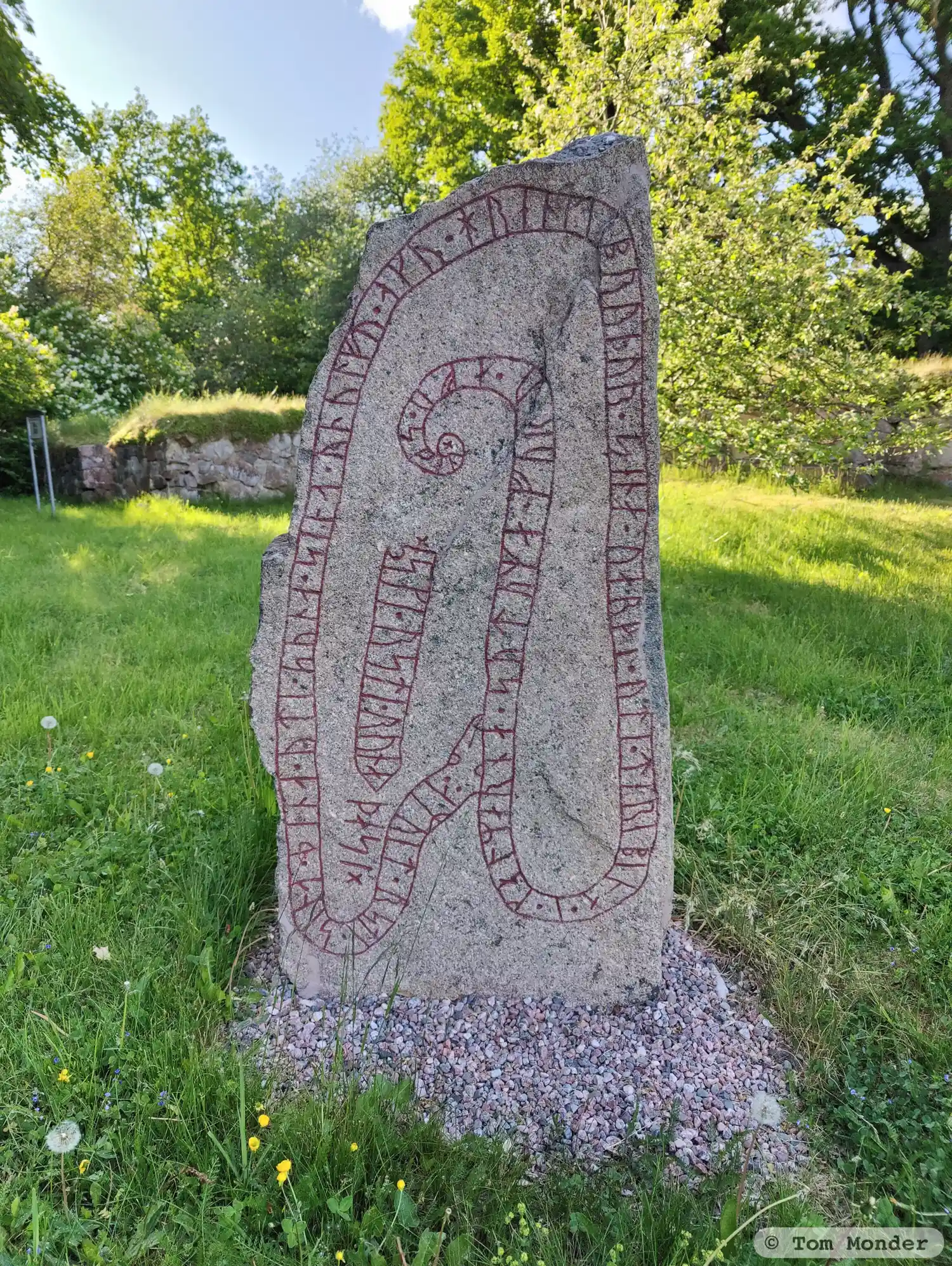
Photo: Tom Monder
Runic inscription
: amuit · rsti · sina · þina · yti · suna · sina · rnulfu/unulfu · aku · hrenki bruþur · sena · uarþi · uti · terebina · i · kalmarna · sutuma · furu · afu · skani ×× eski · rsti · runa · þasi ×
Inscription
: amuit · rsti · sina · þina · yti · suna · sina · rnulfu/unulfu · aku · hrenki bruþur · sena · uarþi · uti · terebina · i · kalmarna · sutuma · furu · afu · skani ×× eski · rsti · runa · þasi ×
Translation
Ámundi(?) raised this stone in memory of his son Rúnulfr/Unnulfr, and Hringr(?), his brother. (He) was killed out in the Kalmarnir sound, (as they) travelled from Scania. Áskell/Ásgeirr carved these runes.
Find the carving
Rune-stone Sö333, L1983:7517 in Åker parish, Strängnäs municipality
Facts
| Monument number | L1983:7517 |
|---|---|
| Swedish National Heritage Board ID | Åker 137:2 |
| Carver | Äskil 1 (S); Äsger (S) [Källström 2007b] |
| Status | Confirmed on location |
| Place | Visible above ground |
| Material | Granite |
| Antiquarian assessment | Ancient monument |
| Damage status | Undamaged |
| County | Södermanland |
| Municipality | Strängnäs |
| Parish | Åker |
| Coordinates | 59.2737645, 17.1319985 |
Sources
Most of the factual information in Runkartan comes from the Swedish National Heritage Board’s Fornsök data and from the Scandinavian Runic Text Database. The maps come from OpenStreetMap and Leaflet.js. The photographs were taken by the credited photographers.