Rune-stone U440, L2016:3954 in Odensala parish, Sigtuna municipality
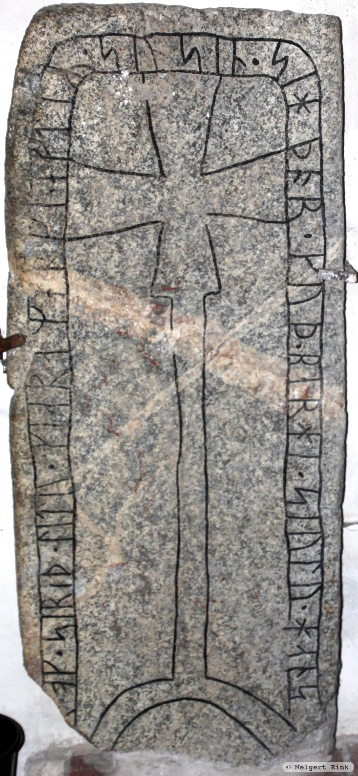
Photo: Melgert Rink
Runic inscription
[þo](r) · ok · siriþ · litu · kiara merki · eftiR · su^n sin · sihþor · kuþ · berhi · siulu · hans
Inscription
[þo](r) · ok · siriþ · litu · kiara merki · eftiR · su^n sin · sihþor · kuþ · berhi · siulu · hans
Translation
Þórðr/Þórðr/Þorn and Sigríðr had the landmark made in memory of their son Sigþórr(?)/Sigþorn(?). May God save his soul.
Find the carving
Rune-stone U440, L2016:3954 in Odensala parish, Sigtuna municipality
Facts
| Monument number | L2016:3954 |
|---|---|
| Swedish National Heritage Board ID | Odensala 123:1 |
| Status | Confirmed on location |
| Place | In building or under water |
| Material | Granite |
| Period | Viking age |
| Antiquarian assessment | Ancient monument |
| Damage status | Undamaged |
| County | Stockholm |
| Municipality | Sigtuna |
| Parish | Odensala |
| Coordinates | 59.6658075, 17.850398 |
Sources
Most of the factual information in Runkartan comes from the Swedish National Heritage Board’s Fornsök data and from the Scandinavian Runic Text Database. The maps come from OpenStreetMap and Leaflet.js. The photographs were taken by the credited photographers.