Rune-stone Mervallastenen, Sö198, L1983:3112 in Ytterselö parish, Strängnäs municipality
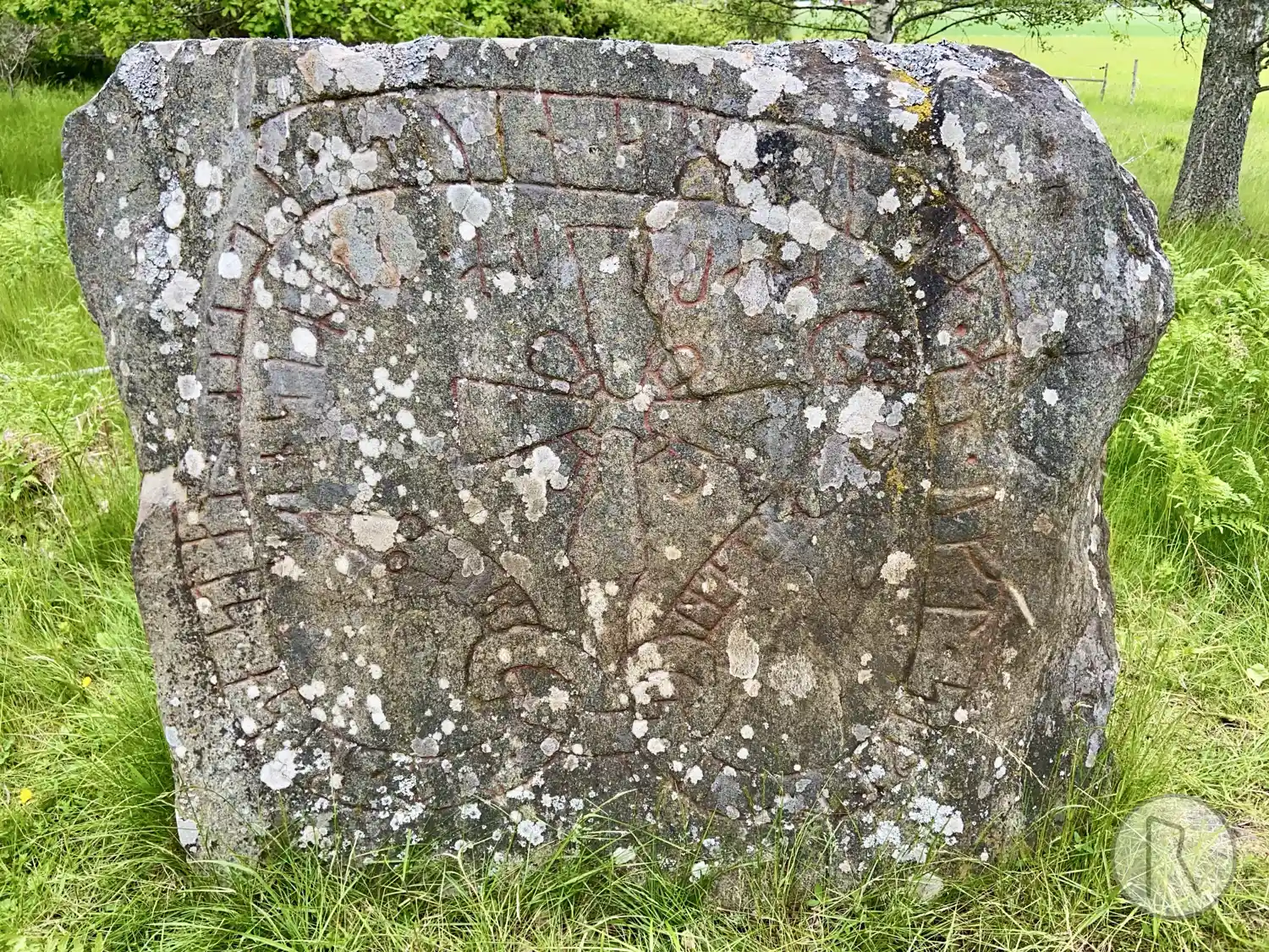
Photo: Niklas Vackerdag
Runic inscription
siriþ · lit · resa · stan · [þin](a) [·] (a)(t) · suen · sin · [b]unta · h[n] · uft · siklt · til · simk(a)(l)(a) · t(u)ru[m] · knari · um · tumisnis
Inscription
siriþ · lit · resa · stan · [þin](a) [·] (a)(t) · suen · sin · [b]unta · h[n] · uft · siklt · til · simk(a)(l)(a) · t(u)ru[m] · knari · um · tumisnis
Translation
Sigríðr had this stone raised in memory of Sveinn, her husbandman. He often sailed a valued cargo-ship to Seimgalir, around Dómisnes.
Find the carving
Rune-stone Mervallastenen, Sö198, L1983:3112 in Ytterselö parish, Strängnäs municipality
Facts
| Monument number | L1983:3112 |
|---|---|
| Swedish National Heritage Board ID | Ytterselö 92:2 |
| Carver | Samma som gjort Sö 200, 207, U 792. (Balle (A)) |
| Status | Confirmed on location |
| Place | Visible above ground |
| Material | Granite |
| Antiquarian assessment | Ancient monument |
| Damage status | Undamaged |
| County | Södermanland |
| Municipality | Strängnäs |
| Parish | Ytterselö |
| Coordinates | 59.381888, 17.189763 |
Sources
Most of the factual information in Runkartan comes from the Swedish National Heritage Board’s Fornsök data and from the Scandinavian Runic Text Database. The maps come from OpenStreetMap and Leaflet.js. The photographs were taken by the credited photographers.