Runic rock inscription Sö331, L1983:2518 in Åker parish, Strängnäs municipality
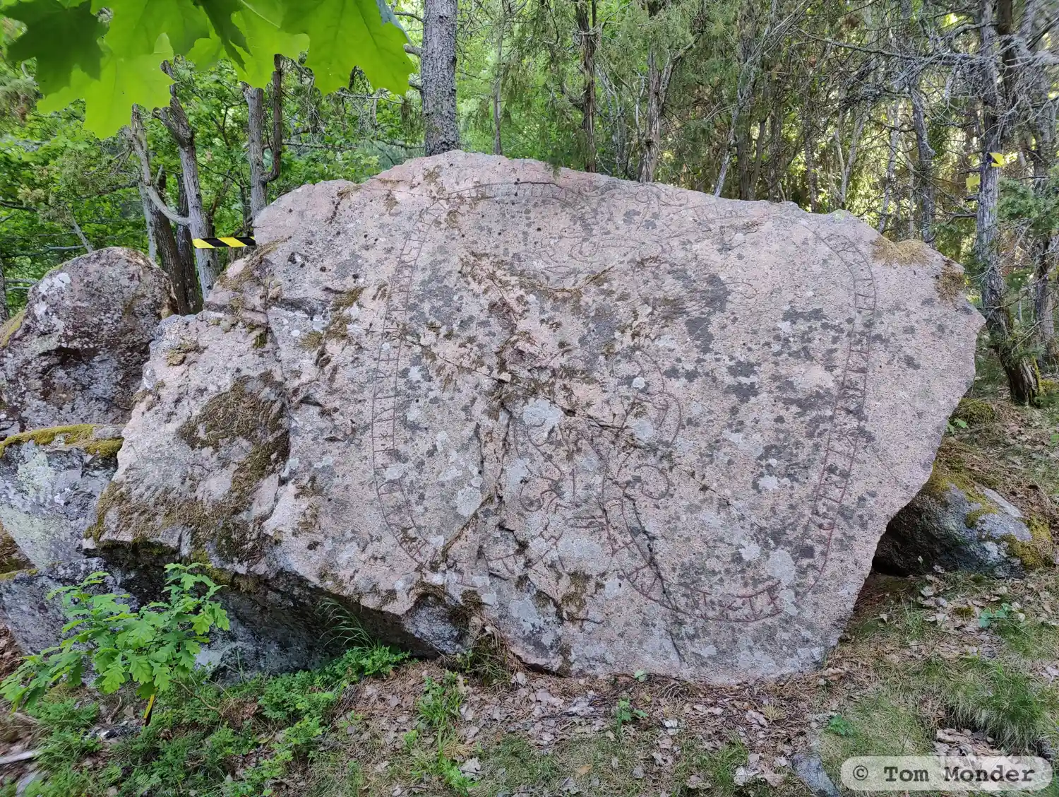
Photo: Tom Monder
Runic inscription
biriR · auk · -(u)(l)ma · litu · kera · mari · þisa · at · hulma ·· sun · sin · koþan · hulmnui · tutr sia · kuþ · hialbi · s(i)(l)u · þaiRa
Inscription
biriR · auk · -(u)(l)ma · litu · kera · mari · þisa · at · hulma ·· sun · sin · koþan · hulmnui · tutr sia · kuþ · hialbi · s(i)(l)u · þaiRa
Translation
Birgir(?)/Býrir(?) and Holma had these landmarks made in memory of Holmi, their good son, (and) Holmvé, their daughter. May God help their souls!
Find the carving
Runic rock inscription Sö331, L1983:2518 in Åker parish, Strängnäs municipality
Facts
| Monument number | L1983:2518 |
|---|---|
| Swedish National Heritage Board ID | Åker 118:2 |
| Carver | Troligen samme ristare som gjort Sö 332 |
| Status | Confirmed on location |
| Place | Visible above ground |
| Antiquarian assessment | Ancient monument |
| Damage status | Undamaged |
| County | Södermanland |
| Municipality | Strängnäs |
| Parish | Åker |
| Coordinates | 59.269614, 17.1021635 |
Sources
Most of the factual information in Runkartan comes from the Swedish National Heritage Board’s Fornsök data and from the Scandinavian Runic Text Database. The maps come from OpenStreetMap and Leaflet.js. The photographs were taken by the credited photographers.