Rune-stone Vg197, L1967:9695 in Dalum parish, Ulricehamn municipality
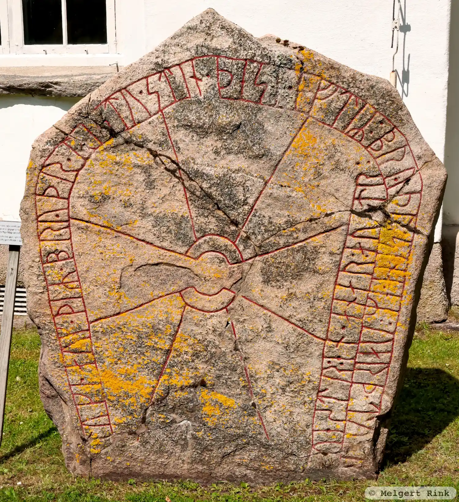
Photo: Melgert Rink
Runic inscription
tuki · auk · þiR · bryþr · ristu · stin · þesi · eftiR : bryþr : sina · eR : uarþ · tu(þ)r uestr : en · anar : au(s)tr :
Inscription
tuki · auk · þiR · bryþr · ristu · stin · þesi · eftiR : bryþr : sina · eR : uarþ · tu(þ)r uestr : en · anar : au(s)tr :
Translation
Tóki and his brothers raised this stone in memory of their brothers. One died in the west, another in the east.
Find the carving
Rune-stone Vg197, L1967:9695 in Dalum parish, Ulricehamn municipality
Facts
| Monument number | L1967:9695 |
|---|---|
| Swedish National Heritage Board ID | Dalum 10:2 |
| Status | Confirmed on location |
| Place | Visible above ground |
| Antiquarian assessment | Ancient monument |
| Damage status | Damage |
| County | Västra Götaland |
| Municipality | Ulricehamn |
| Parish | Dalum |
| Coordinates | 57.8995545, 13.4783565 |
Sources
Most of the factual information in Runkartan comes from the Swedish National Heritage Board’s Fornsök data and from the Scandinavian Runic Text Database. The maps come from OpenStreetMap and Leaflet.js. The photographs were taken by the credited photographers.