Rune-stone U707, L1943:5952 in Kungs-Husby parish, Enköping municipality
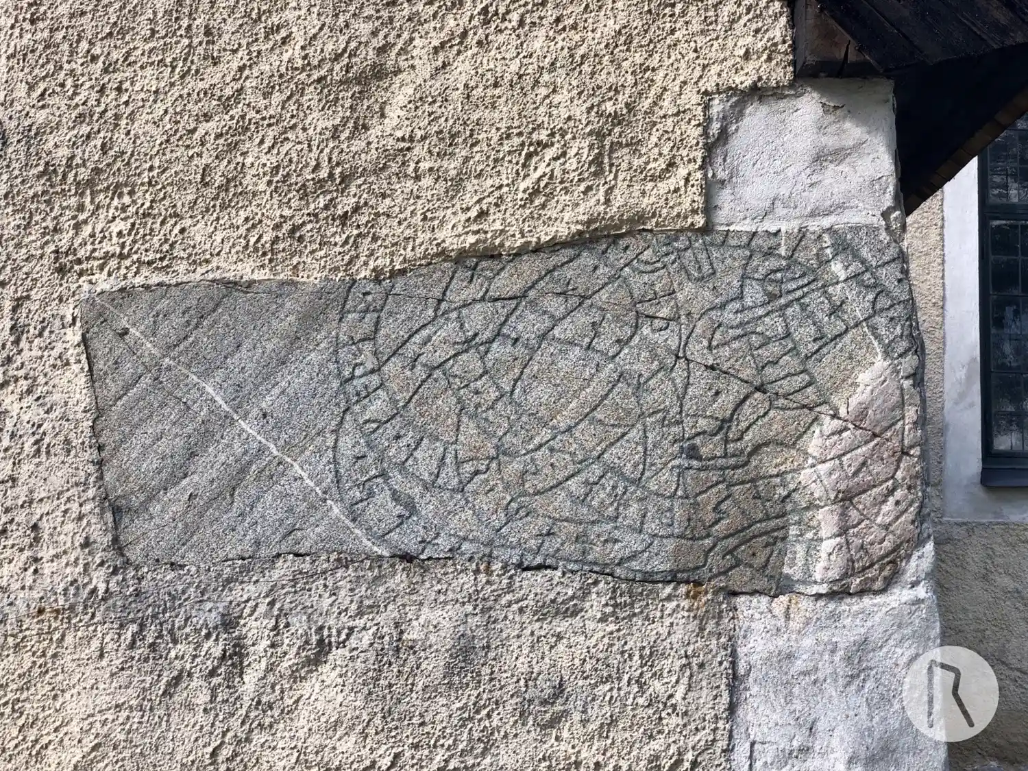
Photo: Niklas Vackerdag
Runic inscription
· ysurkR --... · stan · þina · nt · ka(u)bm...(n) · faþur · sen · koþan · (h)...(n) · byki| |i · h(u)... ¶ · bali · risti · r(u)--r · þis-(r) · hier · man · stanta · stan · ne(r) (b)(r)-...-u ·
Inscription
· ysurkR --... · stan · þina · nt · ka(u)bm...(n) · faþur · sen · koþan · (h)...(n) · byki| |i · h(u)... ¶ · bali · risti · r(u)--r · þis-(r) · hier · man · stanta · stan · ne(r) (b)(r)-...-u ·
Translation
Ósyrgr ... this stone in memory of Kaupmaðr, his good father. He lived in Húsabýr(?) Balli carved these runes. Here will the stone stand near the path.
Find the carving
Rune-stone U707, L1943:5952 in Kungs-Husby parish, Enköping municipality
Facts
| Monument number | L1943:5952 |
|---|---|
| Swedish National Heritage Board ID | Kungs-Husby 90:1 |
| Carver | Balle (S) |
| Status | Confirmed on location |
| Place | In building or under water |
| Material | Granite |
| Antiquarian assessment | Ancient monument |
| Damage status | Damage |
| County | Uppsala |
| Municipality | Enköping |
| Parish | Kungs-Husby |
| Coordinates | 59.522486666667, 17.272391666667 |
Sources
Most of the factual information in Runkartan comes from the Swedish National Heritage Board’s Fornsök data and from the Scandinavian Runic Text Database. The maps come from OpenStreetMap and Leaflet.js. The photographs were taken by the credited photographers.