Rune-stone Galgbacken, U37, L2015:7328 in Sånga parish, Ekerö municipality
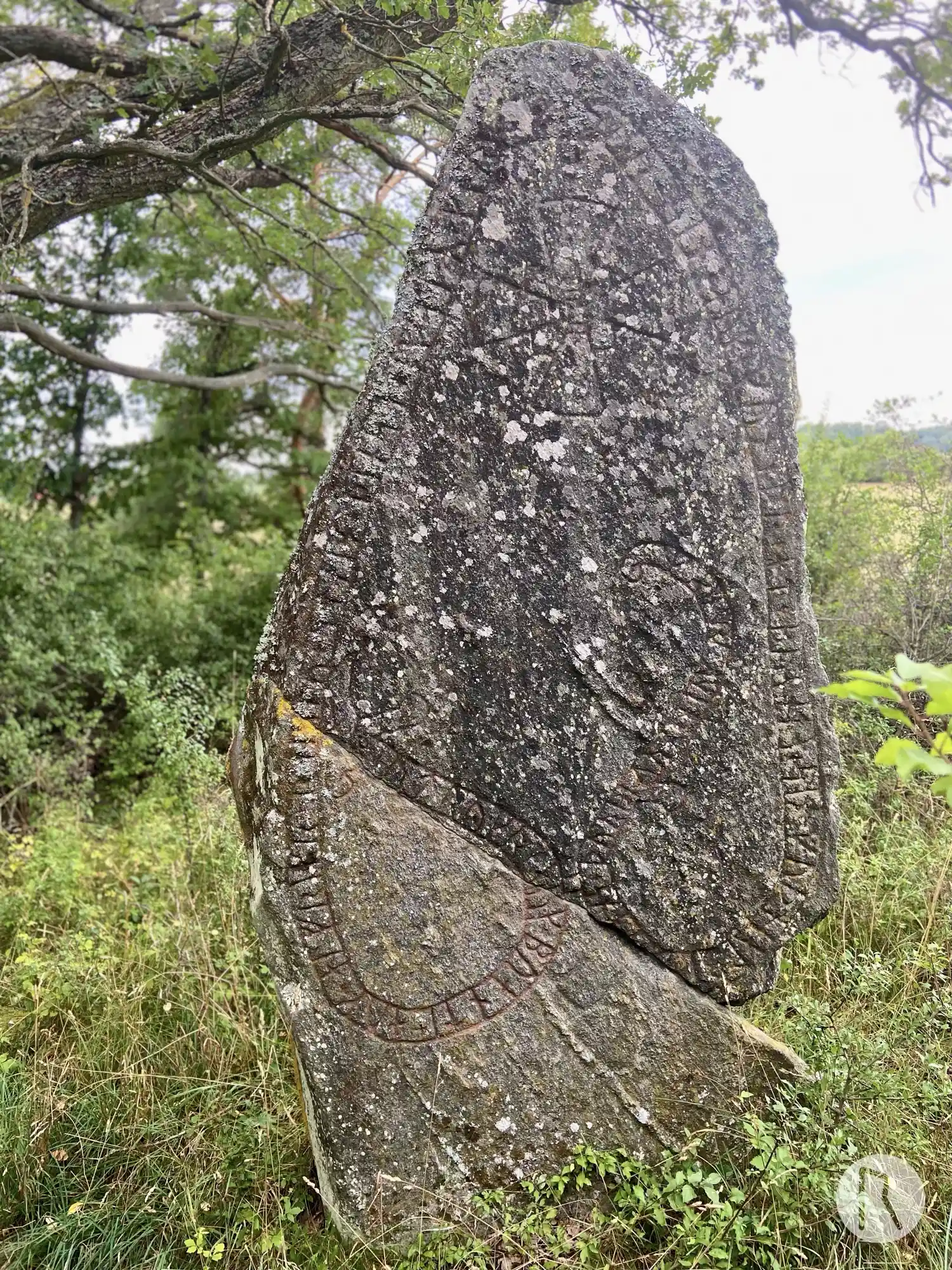
Photo: Niklas Vackerdag
Runic inscription
+ utrykr + auk + buanti + auk + alfrikr + raistu + stain + þinsa + eftiR + kara + faþur + sin + auk + guneþr + at + buanta + sin · guþ hialbi (a)-- -ans + þurbiurn + hiuk ' runaR
Inscription
+ utrykr + auk + buanti + auk + alfrikr + raistu + stain + þinsa + eftiR + kara + faþur + sin + auk + guneþr + at + buanta + sin · guþ hialbi (a)-- -ans + þurbiurn + hiuk ' runaR
Translation
Ótryggr and Bóndi and Alfríkr raised this stone in memory of Kári, their father; and Gunnheiðr in memory of her husbandman. May God help his spirit. Þorbjôrn cut the runes.
Find the carving
Rune-stone Galgbacken, U37, L2015:7328 in Sånga parish, Ekerö municipality
Facts
| Monument number | L2015:7328 |
|---|---|
| Swedish National Heritage Board ID | Sånga 66:2 |
| Carver | Torbjörn skald (S) |
| Status | Confirmed on location |
| Place | Visible above ground |
| Material | Granite |
| Antiquarian assessment | Ancient monument |
| Damage status | Unknown |
| County | Stockholm |
| Municipality | Ekerö |
| Parish | Sånga |
| Coordinates | 59.374103, 17.672619 |
Sources
Most of the factual information in Runkartan comes from the Swedish National Heritage Board’s Fornsök data and from the Scandinavian Runic Text Database. The maps come from OpenStreetMap and Leaflet.js. The photographs were taken by the credited photographers.