Rune-stone Gripsholmsstenen, Sö179, L1985:8289 in Kärnbo parish, Strängnäs municipality
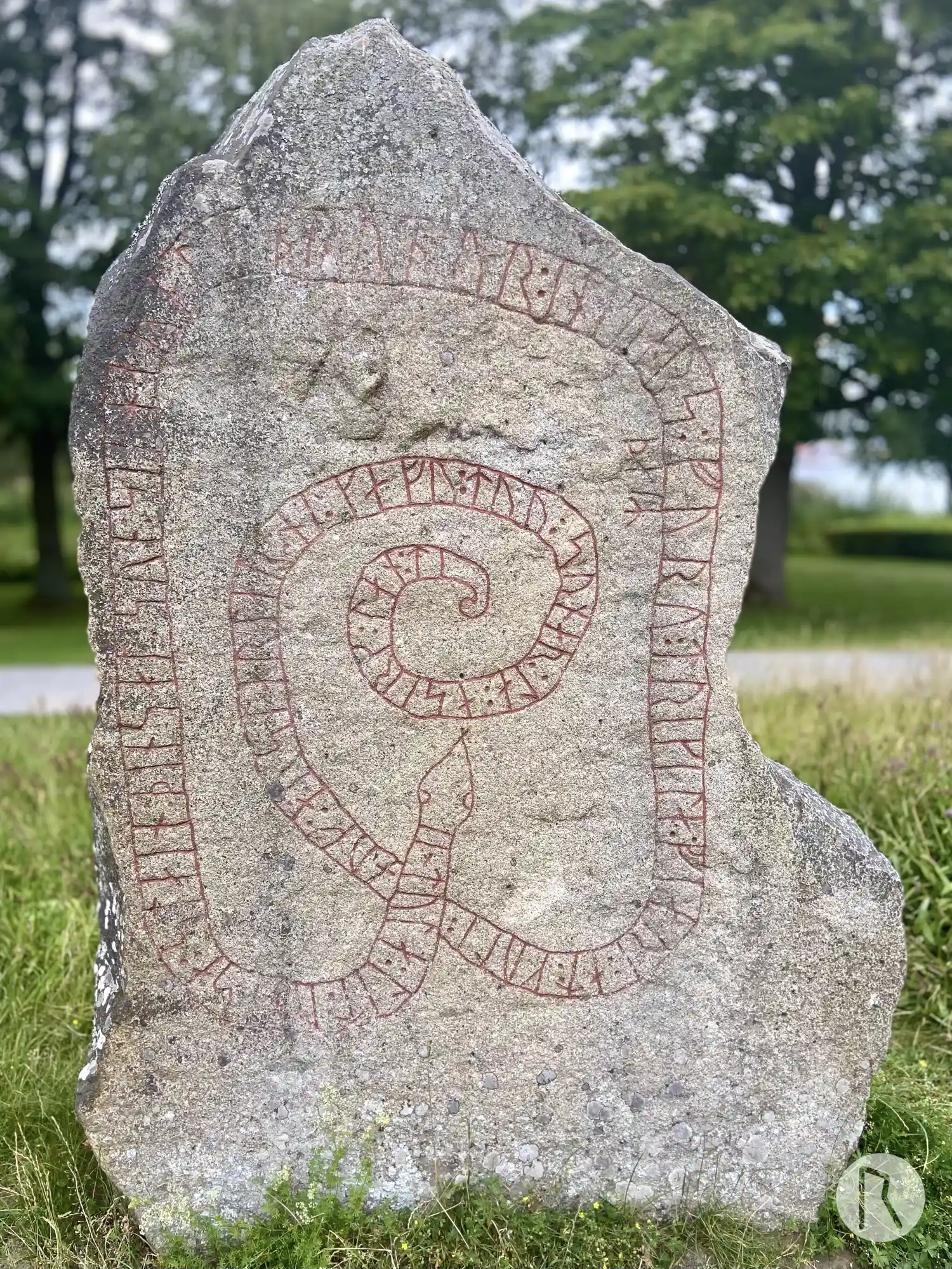
Photo: Niklas Vackerdag
Runic inscription
× tula : lit : raisa : stain : þinsa| |at : sun : sin : haralt : bruþur : inkuars : þaiR furu : trikila : fiari : at : kuli : auk : a:ustarla| |ar:ni : kafu : tuu : sunar:la : a sirk:lan:ti
Inscription
× tula : lit : raisa : stain : þinsa| |at : sun : sin : haralt : bruþur : inkuars : þaiR furu : trikila : fiari : at : kuli : auk : a:ustarla| |ar:ni : kafu : tuu : sunar:la : a sirk:lan:ti
Translation
Tóla had this stone raised in memory of her son Haraldr, Ingvarr's brother. They travelled valiantly far for gold, and in the east gave (food) to the eagle. (They) died in the south in Serkland.
Find the carving
Rune-stone Gripsholmsstenen, Sö179, L1985:8289 in Kärnbo parish, Strängnäs municipality
Facts
| Monument number | L1985:8289 |
|---|---|
| Swedish National Heritage Board ID | Kärnbo 33:1 |
| Carver | Äskil 2 (A) |
| Status | Confirmed on location |
| Place | Visible above ground |
| Material | Granite |
| Period | Viking age |
| Antiquarian assessment | Ancient monument |
| Damage status | Undamaged |
| County | Södermanland |
| Municipality | Strängnäs |
| Parish | Kärnbo |
| Coordinates | 59.256983, 17.218075 |
Sources
Most of the factual information in Runkartan comes from the Swedish National Heritage Board’s Fornsök data and from the Scandinavian Runic Text Database. The maps come from OpenStreetMap and Leaflet.js. The photographs were taken by the credited photographers.