Rune-stone Ög161, L2011:568 in Kimstad parish, Norrköping municipality
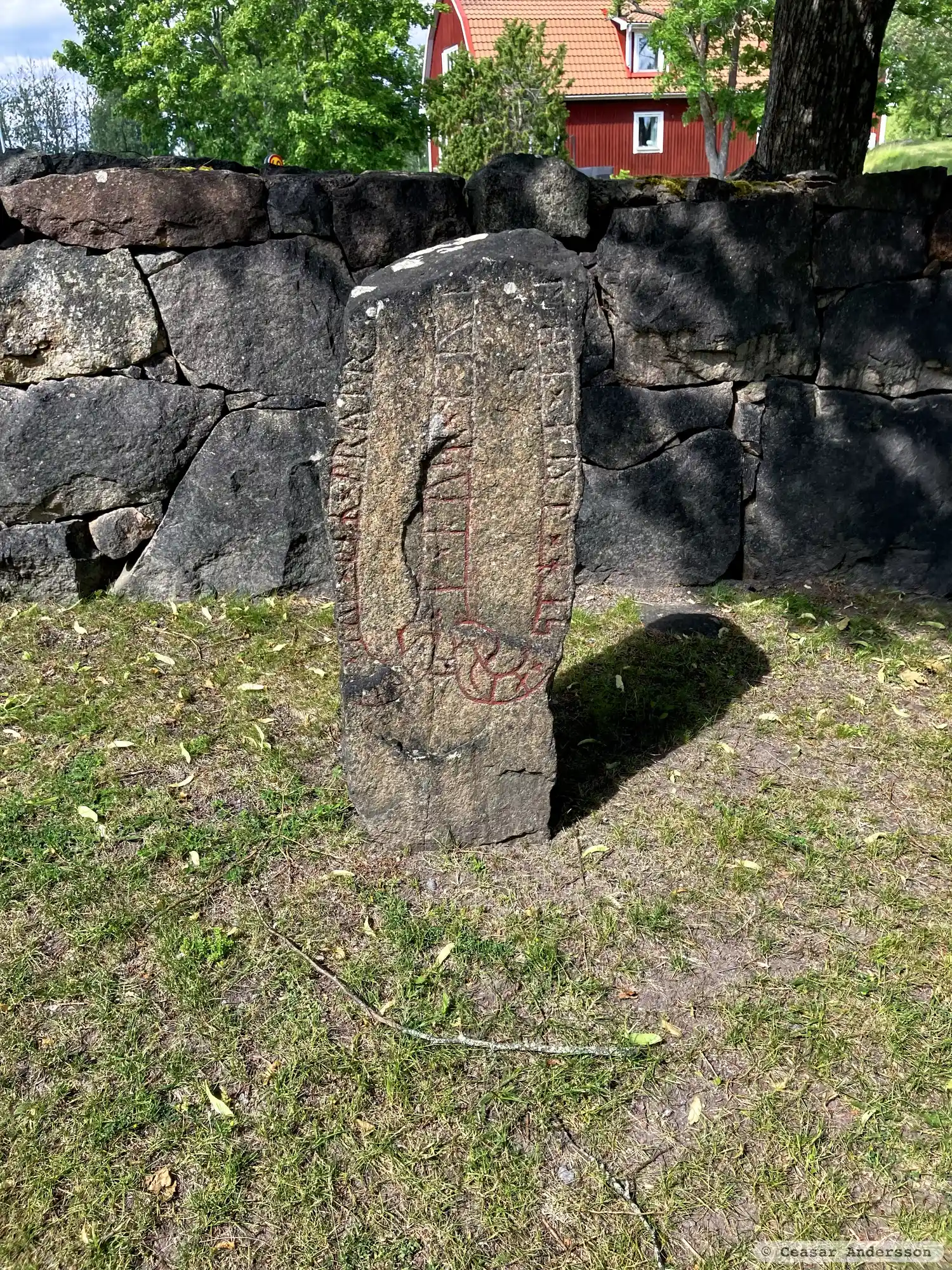
Photo: Ceasar Andersson
Runic inscription
× suen [×] auk × þeR × bryþr × r[istu × stein × iftR × kaþur × sin × iart × kuþ × h...]lbi × aut × has × auk × kus × muþ[-R × i × lius ×]
Inscription
× suen [×] auk × þeR × bryþr × r[istu × stein × iftR × kaþur × sin × iart × kuþ × h...]lbi × aut × has × auk × kus × muþ[-R × i × lius ×]
Translation
Sveinn and his brothers raised the stone in memory of their father Jarl. May God and God's mother help his spirit into light.
Find the carving
Rune-stone Ög161, L2011:568 in Kimstad parish, Norrköping municipality
Facts
| Monument number | L2011:568 |
|---|---|
| Swedish National Heritage Board ID | Kimstad 42:1 |
| Status | Confirmed on location |
| Place | Visible above ground |
| Antiquarian assessment | Ancient monument |
| Damage status | Damage |
| County | Östergötland |
| Municipality | Norrköping |
| Parish | Kimstad |
| Coordinates | 58.5397125, 15.97373 |
Sources
Most of the factual information in Runkartan comes from the Swedish National Heritage Board’s Fornsök data and from the Scandinavian Runic Text Database. The maps come from OpenStreetMap and Leaflet.js. The photographs were taken by the credited photographers.