Rune-stone Ög105, L2011:2294 in Kärna parish, Linköping municipality
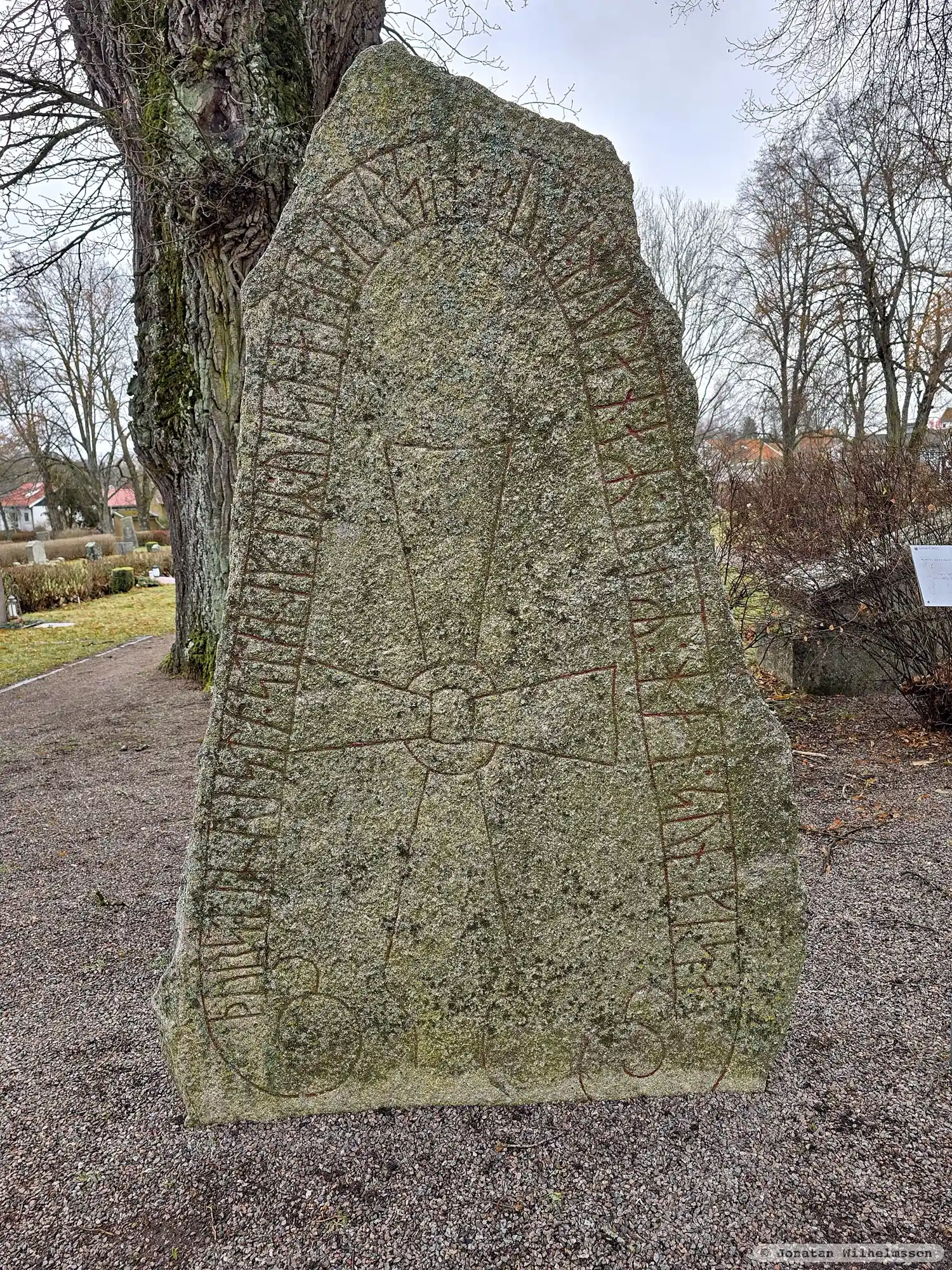
Photo: Jonatan Wilhelmsson
Runic inscription
þurstin : risti : stin : iftiR : uista : faþur sin : buta : nutan : aR : uaR : han : sun : kisa :
Inscription
þurstin : risti : stin : iftiR : uista : faþur sin : buta : nutan : aR : uaR : han : sun : kisa :
Translation
Þorsteinn raised the stone in memory of Véseti, his father, a capable husbandman, who was Gísi's son.
Find the carving
Rune-stone Ög105, L2011:2294 in Kärna parish, Linköping municipality
Facts
| Monument number | L2011:2294 |
|---|---|
| Swedish National Heritage Board ID | Kärna 6:1 |
| Status | Confirmed on location |
| Place | Visible above ground |
| Antiquarian assessment | Ancient monument |
| Damage status | Undamaged |
| County | Östergötland |
| Municipality | Linköping |
| Parish | Kärna |
| Coordinates | 58.416768, 15.522881 |
Sources
Most of the factual information in Runkartan comes from the Swedish National Heritage Board’s Fornsök data and from the Scandinavian Runic Text Database. The maps come from OpenStreetMap and Leaflet.js. The photographs were taken by the credited photographers.