Rune-stone Sm144, L1958:3087 in Gamleby parish, Västervik municipality
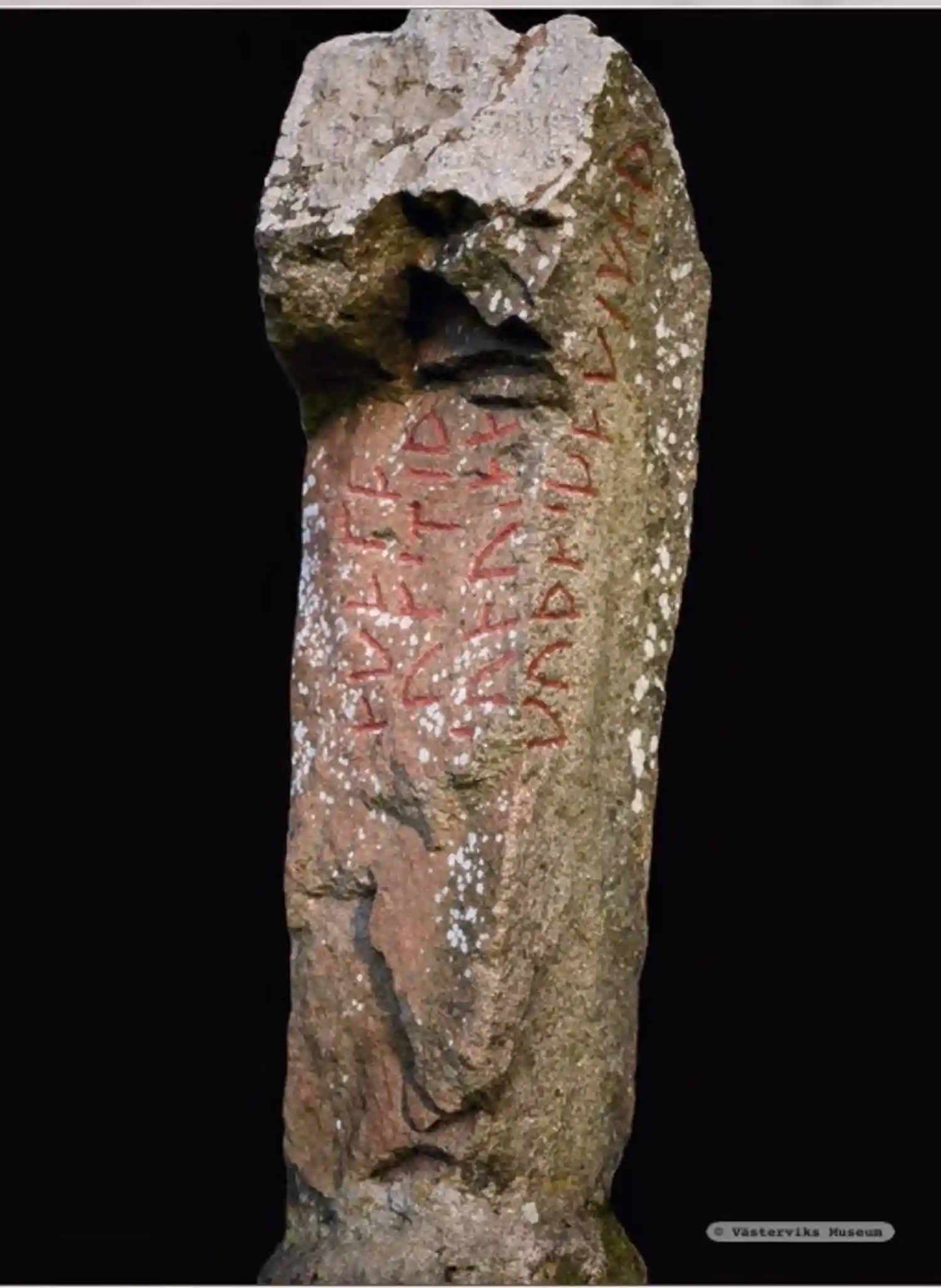
Photo: Västerviks Museum
Runic inscription
§P §A sunuR na¶ut smiþ¶a kata §B uifrþaR ...un... §C kuþaskaki faþi §Q §A kuþaskaki faþi §B sunuR na¶ut smiþ¶a kata §C uif siþaR un...
Inscription
§P §A sunuR na¶ut smiþ¶a kata §B uifrþaR ...un... §C kuþaskaki faþi §Q §A kuþaskaki faþi §B sunuR na¶ut smiþ¶a kata §C uif siþaR un...
Translation
§P §AB The son made good use of Káti Véfríðarson's/Véfrøðarson's handiwork. §C Guða-Skeggi/Skakki/Skagi coloured. §Q Goða-Skeggi (i.e. Skeggi of the goði or goðar) coloured. The son got (or: made good use of) Káti's handiwork. The wife later granted (or: permitted).
Find the carving
Rune-stone Sm144, L1958:3087 in Gamleby parish, Västervik municipality
Facts
| Monument number | L1958:3087 |
|---|---|
| Swedish National Heritage Board ID | Gamleby 393:1 |
| Status | Confirmed on location |
| Place | Visible above ground |
| Antiquarian assessment | Ancient monument |
| Damage status | Undamaged |
| County | Kalmar |
| Municipality | Västervik |
| Parish | Gamleby |
| Coordinates | 57.9065355, 16.4119165 |
Sources
Most of the factual information in Runkartan comes from the Swedish National Heritage Board’s Fornsök data and from the Scandinavian Runic Text Database. The maps come from OpenStreetMap and Leaflet.js. The photographs were taken by the credited photographers.