Rune-stone Vs1, L2003:7201 in Rytterne parish, Västerås municipality
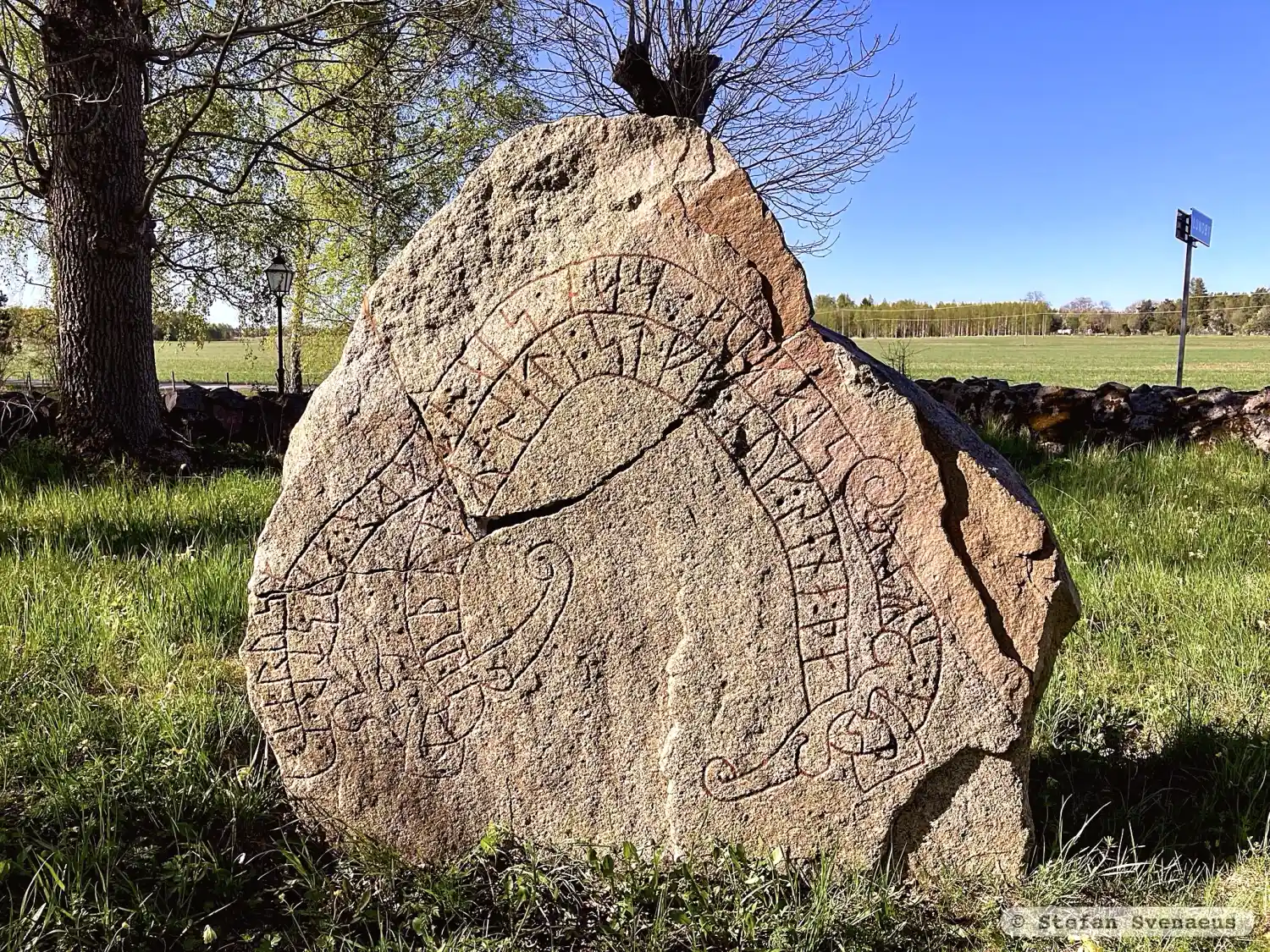
Photo: Stefan Svenaeus
Runic inscription
+ kuþlefR + seti : stff : auk : sena : þasi : uftiR slakua : sun : sia : etaþr : austr · i · karusm ·
Inscription
+ kuþlefR + seti : stff : auk : sena : þasi : uftiR slakua : sun : sia : etaþr : austr · i · karusm ·
Translation
Guðleifr placed the staff and these stones in memory of Slagvi, his son, (who) met his end in the east in Garðar(?)/Chorezm(?).
Find the carving
Rune-stone Vs1, L2003:7201 in Rytterne parish, Västerås municipality
Facts
| Monument number | L2003:7201 |
|---|---|
| Swedish National Heritage Board ID | Rytterne 52:1 |
| Carver | Ovan ristare. |
| Status | Confirmed on location |
| Place | Visible above ground |
| Material | Gray and reddish granite |
| Antiquarian assessment | Ancient monument |
| Damage status | Damage |
| County | Västmanland |
| Municipality | Västerås |
| Parish | Rytterne |
| Coordinates | 59.5125315, 16.3424085 |
Sources
Most of the factual information in Runkartan comes from the Swedish National Heritage Board’s Fornsök data and from the Scandinavian Runic Text Database. The maps come from OpenStreetMap and Leaflet.js. The photographs were taken by the credited photographers.