Rune-stone U652, L1941:5164 in Övergran parish, Håbo municipality
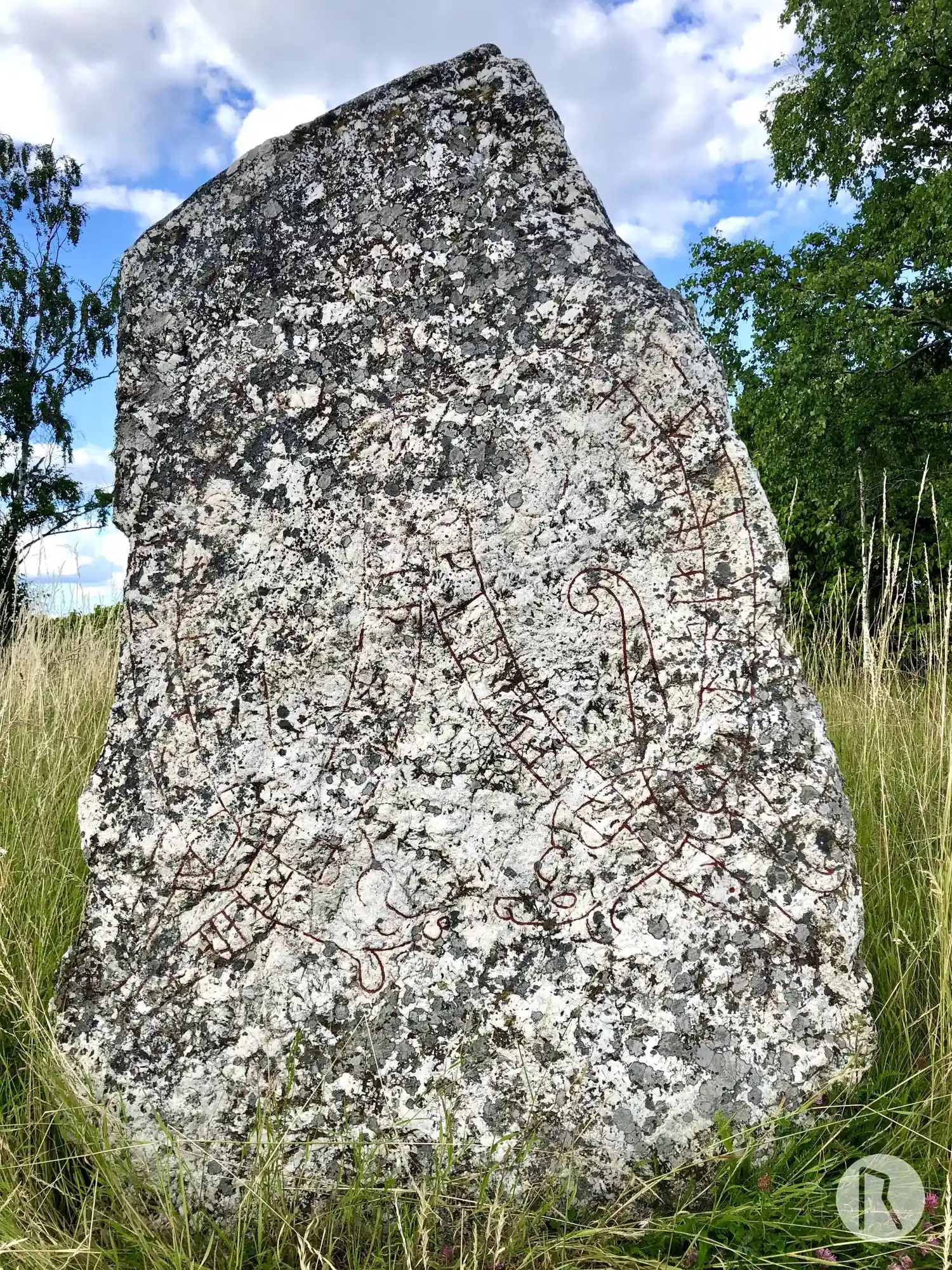
Photo: Niklas Vackerdag
Runic inscription
[k]u[ni]tr · let · (k)(e)ra · [m]erki · þesa · at ·· þial[f]- · su[n ·] sin · auk · [i]ftir · sik · sialfa ·· ar[b]iurn · iuk ·· stain · þinsa ·
Inscription
[k]u[ni]tr · let · (k)(e)ra · [m]erki · þesa · at ·· þial[f]- · su[n ·] sin · auk · [i]ftir · sik · sialfa ·· ar[b]iurn · iuk ·· stain · þinsa ·
Translation
Gunnhildr had these landmarks made in memory of Þjalfi, her son, and in memory of herself. Arnbjôrn cut this stone.
Find the carving
Rune-stone U652, L1941:5164 in Övergran parish, Håbo municipality
Facts
| Monument number | L1941:5164 |
|---|---|
| Swedish National Heritage Board ID | Övergran 65:1 |
| Carver | Arbjörn (S) |
| Status | Confirmed on location |
| Place | Visible above ground |
| Material | Light quartz-rich granite |
| Antiquarian assessment | Ancient monument |
| Damage status | Unknown |
| County | Uppsala |
| Municipality | Håbo |
| Parish | Övergran |
| Coordinates | 59.635755, 17.470703333333 |
Sources
Most of the factual information in Runkartan comes from the Swedish National Heritage Board’s Fornsök data and from the Scandinavian Runic Text Database. The maps come from OpenStreetMap and Leaflet.js. The photographs were taken by the credited photographers.