Rune-stone Skälbystenen, U279, L2017:4063 in Hammarby parish, Upplands Väsby municipality
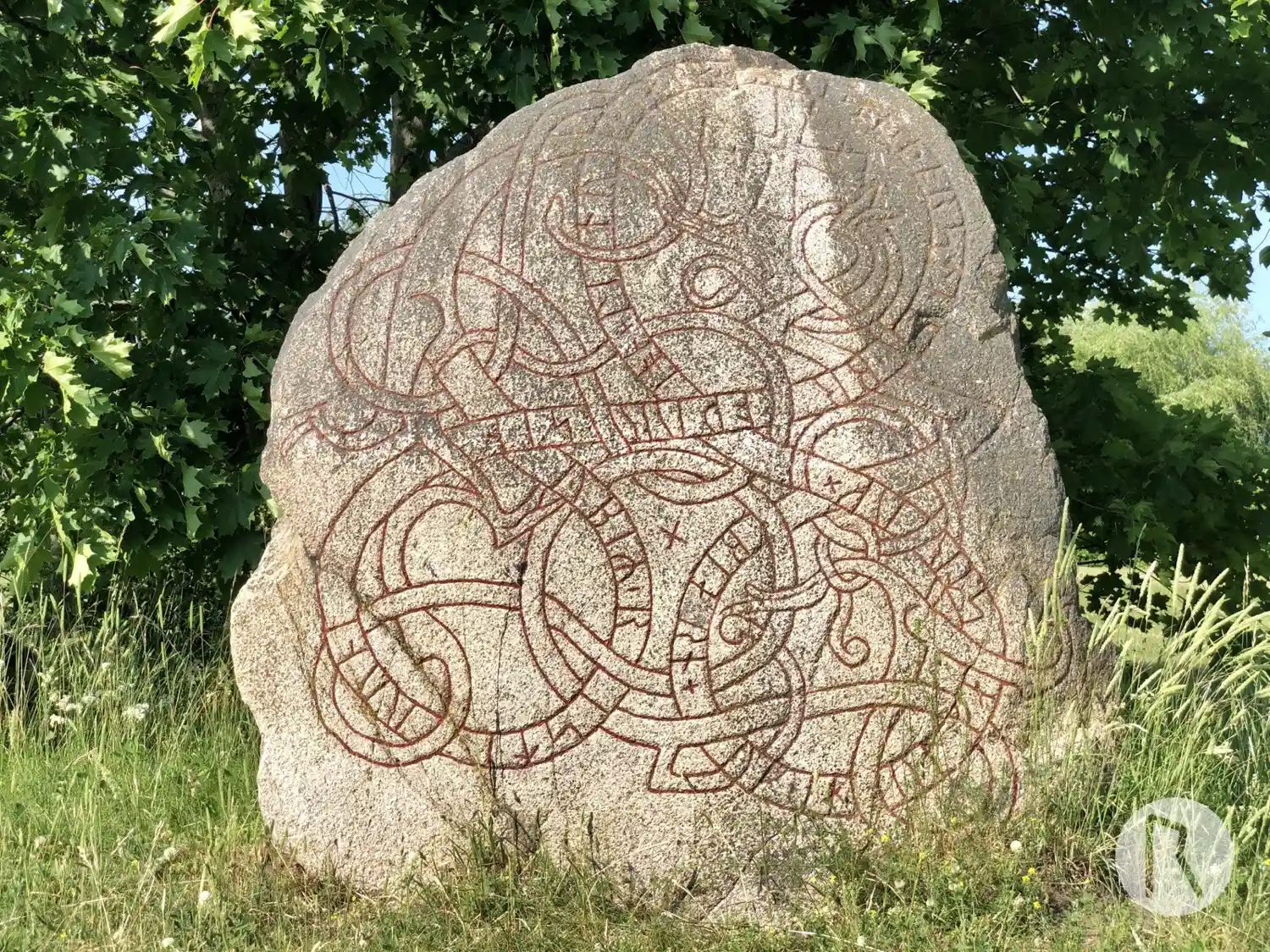
Photo: Niklas Vackerdag
Runic inscription
biarn + uk ' ihulfastr uk × ion + litu kiara ' (b)ro ' at ' þorsti(n) ' broþur sin ybiR ' risti runa
Inscription
biarn + uk ' ihulfastr uk × ion + litu kiara ' (b)ro ' at ' þorsti(n) ' broþur sin ybiR ' risti runa
Translation
Bjôrn and Ígulfastr and Jón had the bridge made in memory of Þorsteinn, their brother. Œpir carved the runes.
Find the carving
Rune-stone Skälbystenen, U279, L2017:4063 in Hammarby parish, Upplands Väsby municipality
Facts
| Monument number | L2017:4063 |
|---|---|
| Swedish National Heritage Board ID | Hammarby 123:1 |
| Carver | Öpir 1 (S) |
| Status | Confirmed on location |
| Place | Visible above ground |
| Material | Granite |
| Period | Viking age |
| Antiquarian assessment | Ancient monument |
| Damage status | Undamaged |
| County | Stockholm |
| Municipality | Upplands Väsby |
| Parish | Hammarby |
| Coordinates | 59.529863, 17.933362 |
Sources
Most of the factual information in Runkartan comes from the Swedish National Heritage Board’s Fornsök data and from the Scandinavian Runic Text Database. The maps come from OpenStreetMap and Leaflet.js. The photographs were taken by the credited photographers.