Rune-stone Kungsbacken, Vg4, L1962:152 in Ek parish, Mariestad municipality
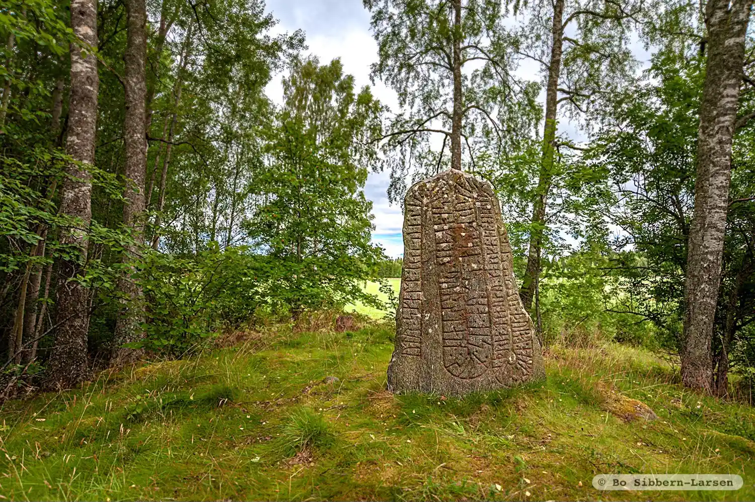
Photo: Bo Sibbern-Larsen
Runic inscription
utr : skalt : raisti : stain : þinsi : aftir : þurstain : sun : sin : auk : stain:bru : karþi : (f)(i)(r)(i)(r) : (i)(s) : (a)(t)(i) : (þ)ria : buia : i : homri · auk : þria : tiauku : marka : at : airiki
Inscription
utr : skalt : raisti : stain : þinsi : aftir : þurstain : sun : sin : auk : stain:bru : karþi : (f)(i)(r)(i)(r) : (i)(s) : (a)(t)(i) : (þ)ria : buia : i : homri · auk : þria : tiauku : marka : at : airiki
Translation
Oddr Skald raised this stone and made the stone-bridge in memory of Þorsteinn, his son. He owned three estates in 'hamarr'-partition and thirty marks (deposit) with Eiríkr.
Find the carving
Rune-stone Kungsbacken, Vg4, L1962:152 in Ek parish, Mariestad municipality
Facts
| Monument number | L1962:152 |
|---|---|
| Swedish National Heritage Board ID | Ek 1:1 |
| Status | Confirmed on location |
| Place | Visible above ground |
| Antiquarian assessment | Ancient monument |
| Damage status | Damage |
| County | Västra Götaland |
| Municipality | Mariestad |
| Parish | Ek |
| Coordinates | 58.6298875, 13.8214235 |
Sources
Most of the factual information in Runkartan comes from the Swedish National Heritage Board’s Fornsök data and from the Scandinavian Runic Text Database. The maps come from OpenStreetMap and Leaflet.js. The photographs were taken by the credited photographers.