Rune-stone Vg155, L1966:9828 in Hol parish, Vårgårda municipality
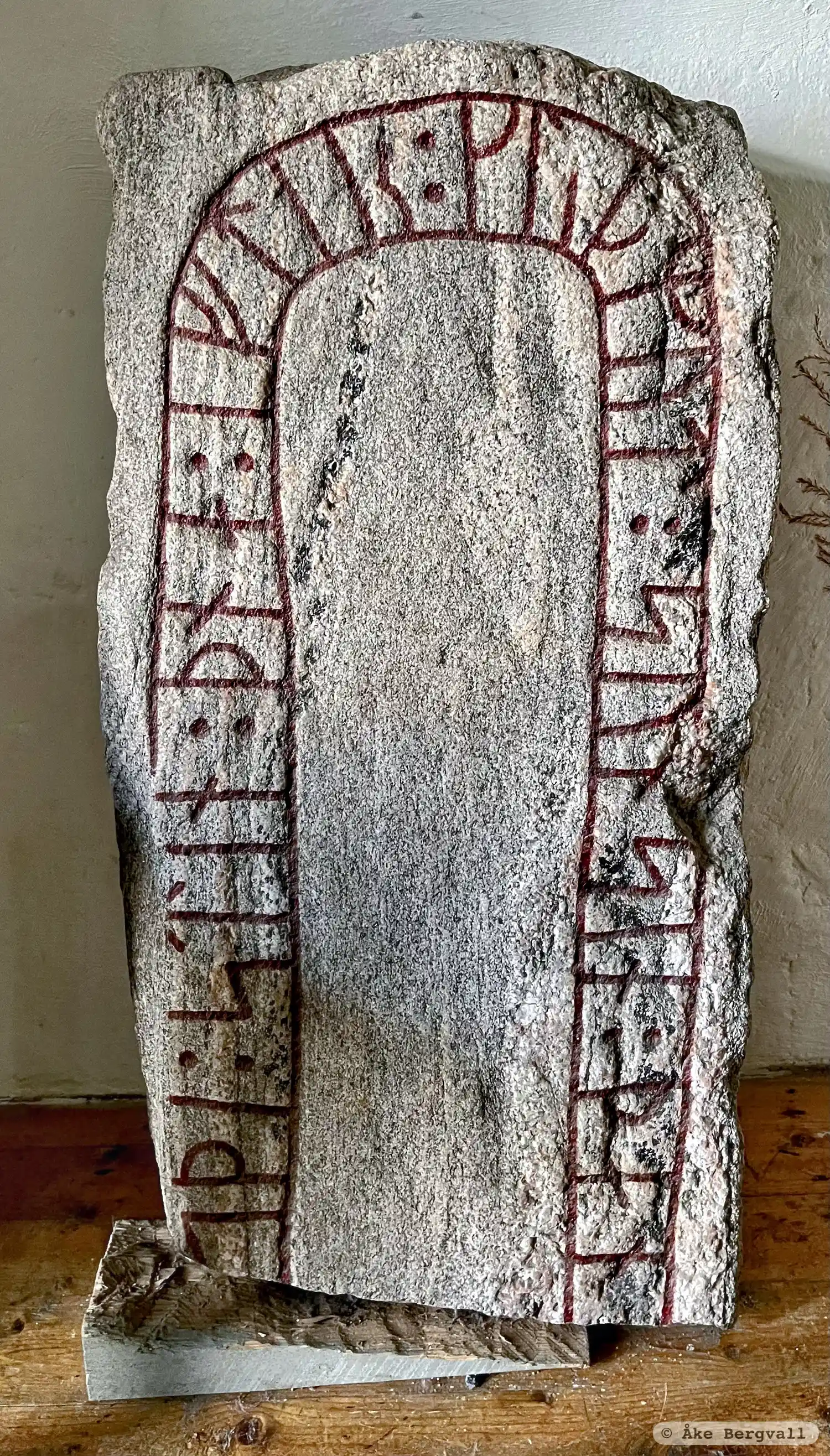
Photo: Åke Bergvall
Runic inscription
... ...(s)(þ)i : stin : þna : iftiR : kuþmut : sun sin : þa-...
Inscription
... ...(s)(þ)i : stin : þna : iftiR : kuþmut : sun sin : þa-...
Translation
... raised this stone in memory of Guðmund, his son ...
Find the carving
Rune-stone Vg155, L1966:9828 in Hol parish, Vårgårda municipality
Facts
| Monument number | L1966:9828 |
|---|---|
| Swedish National Heritage Board ID | Hol 1:1 |
| Status | Confirmed on location |
| Place | Visible above ground |
| Antiquarian assessment | Ancient monument |
| Damage status | Damage |
| County | Västra Götaland |
| Municipality | Vårgårda |
| Parish | Hol |
| Coordinates | 57.9745845, 12.664685 |
Sources
Most of the factual information in Runkartan comes from the Swedish National Heritage Board’s Fornsök data and from the Scandinavian Runic Text Database. The maps come from OpenStreetMap and Leaflet.js. The photographs were taken by the credited photographers.