Rune-stone Vg160, L1965:2220 in Hällstad parish, Ulricehamn municipality
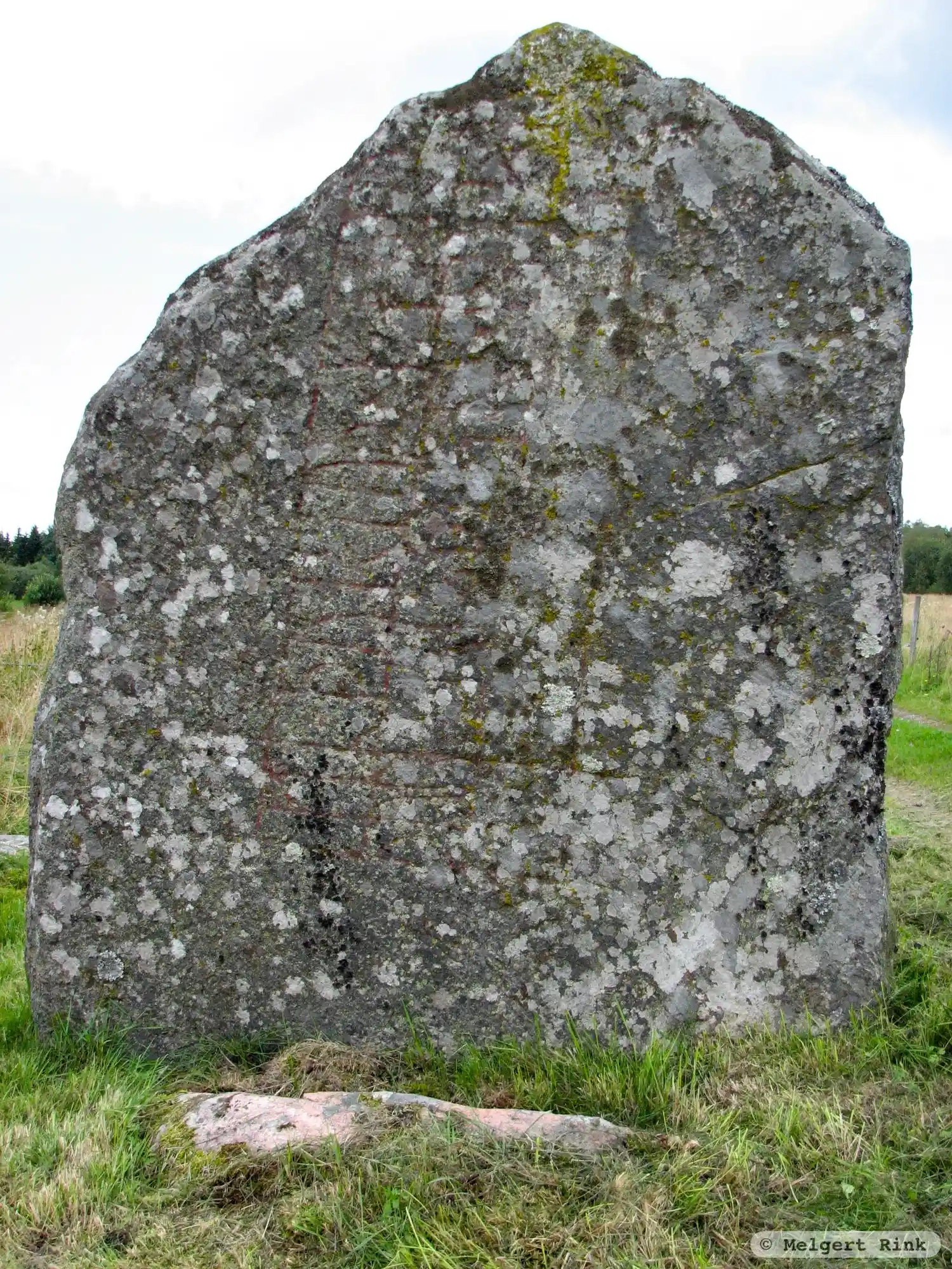
Photo: Melgert Rink
Runic inscription
þuri × risþi stn × þansi iftR × þuriuþ × faþur si(n)
Inscription
þuri × risþi stn × þansi iftR × þuriuþ × faþur si(n)
Translation
Þórir raised this stone in memory of Þorviðr(?), his father.
Find the carving
Rune-stone Vg160, L1965:2220 in Hällstad parish, Ulricehamn municipality
Facts
| Monument number | L1965:2220 |
|---|---|
| Swedish National Heritage Board ID | Hällstad 16:1 |
| Status | Confirmed on location |
| Place | Visible above ground |
| Antiquarian assessment | Ancient monument |
| Damage status | Undamaged |
| County | Västra Götaland |
| Municipality | Ulricehamn |
| Parish | Hällstad |
| Coordinates | 57.8769215, 13.296315 |
Sources
Most of the factual information in Runkartan comes from the Swedish National Heritage Board’s Fornsök data and from the Scandinavian Runic Text Database. The maps come from OpenStreetMap and Leaflet.js. The photographs were taken by the credited photographers.