Rune-stone U1127, L1944:4042 in Alunda parish, Östhammar municipality
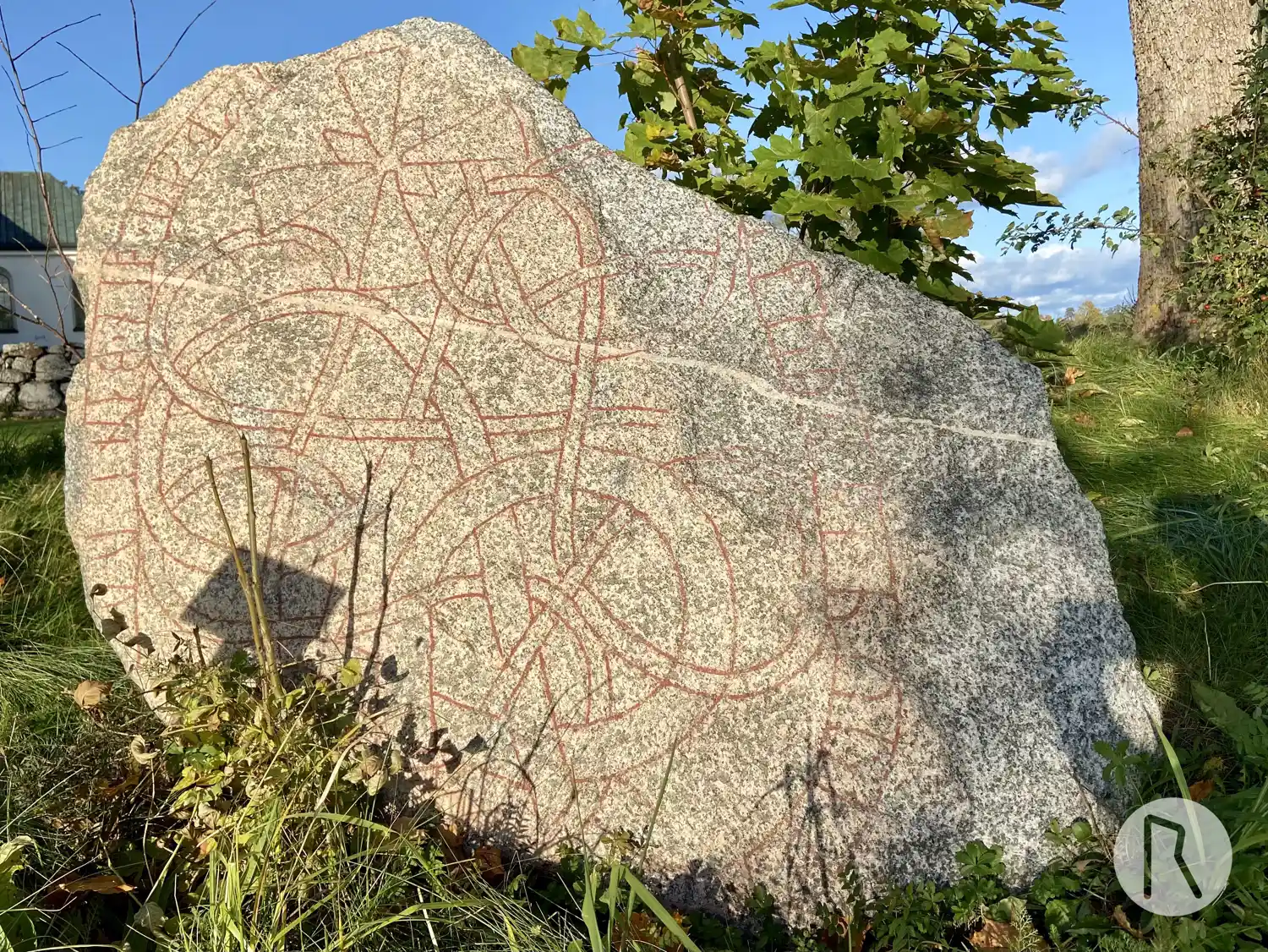
Photo: Niklas Vackerdag
Runic inscription
fasti ' ak ' iukiR ' þi| |iltu ris| |stin aftiR bru(þ) sin ' þurot
Inscription
fasti ' ak ' iukiR ' þi| |iltu ris| |stin aftiR bru(þ) sin ' þurot
Translation
Fasti and Jógeirr, they had the stone raised in memory of their brother Þróndr.
Find the carving
Rune-stone U1127, L1944:4042 in Alunda parish, Östhammar municipality
Facts
| Monument number | L1944:4042 |
|---|---|
| Swedish National Heritage Board ID | Alunda 37:2 |
| Status | Confirmed on location |
| Place | Visible above ground |
| Material | Blue-gray granite |
| Antiquarian assessment | Ancient monument |
| Damage status | Damage |
| County | Uppsala |
| Municipality | Östhammar |
| Parish | Alunda |
| Coordinates | 60.059164, 18.068339 |
Sources
Most of the factual information in Runkartan comes from the Swedish National Heritage Board’s Fornsök data and from the Scandinavian Runic Text Database. The maps come from OpenStreetMap and Leaflet.js. The photographs were taken by the credited photographers.