Rune-stone U708, L1943:6108 in Kungs-Husby parish, Enköping municipality
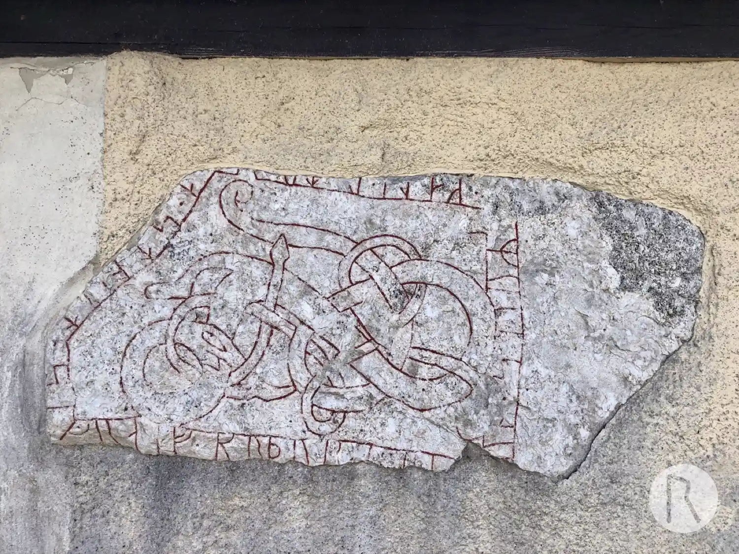
Photo: Niklas Vackerdag
Runic inscription
· kali · l-t (r)...--a · stn · (a)t · sigraif · brþur · --- ...un · sairR ·
Inscription
· kali · l-t (r)...--a · stn · (a)t · sigraif · brþur · --- ...un · sairR ·
Translation
Kali had the stone raised in memory of Sigreifr, his brother, <sairR>'s son(?).
Find the carving
Rune-stone U708, L1943:6108 in Kungs-Husby parish, Enköping municipality
Facts
| Monument number | L1943:6108 |
|---|---|
| Swedish National Heritage Board ID | Kungs-Husby 3:1 |
| Carver | Balle (A) |
| Status | Confirmed on location |
| Place | Visible above ground |
| Material | Granite with white quartz-surface |
| Period | Viking age |
| Antiquarian assessment | Other cultural-historical relic |
| Damage status | Unknown |
| County | Uppsala |
| Municipality | Enköping |
| Parish | Kungs-Husby |
| Coordinates | 59.522495, 17.272421666667 |
Sources
Most of the factual information in Runkartan comes from the Swedish National Heritage Board’s Fornsök data and from the Scandinavian Runic Text Database. The maps come from OpenStreetMap and Leaflet.js. The photographs were taken by the credited photographers.