Runic inscription U192, L2014:3638 in Össeby-Garn parish, Vallentuna municipality
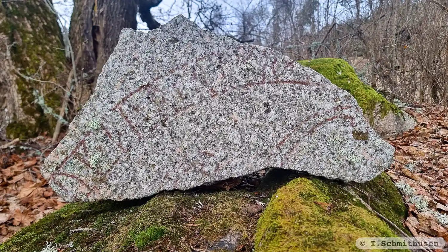
Photo: T.Schmithüsen
Runic inscription
... uk × þurkrimr × -...
Inscription
... uk × þurkrimr × -...
Translation
... and Þorgrímr ...
Find the carving
Runic inscription U192, L2014:3638 in Össeby-Garn parish, Vallentuna municipality
Facts
| Monument number | L2014:3638 |
|---|---|
| Swedish National Heritage Board ID | Össeby-Garn 31:1 |
| Status | Confirmed on location |
| Place | Visible above ground |
| Material | Granite |
| Period | Viking age |
| Antiquarian assessment | Ancient monument |
| Damage status | Unknown |
| County | Stockholm |
| Municipality | Vallentuna |
| Parish | Össeby-Garn |
| Coordinates | 59.5230655, 18.254794 |
Sources
Most of the factual information in Runkartan comes from the Swedish National Heritage Board’s Fornsök data and from the Scandinavian Runic Text Database. The maps come from OpenStreetMap and Leaflet.js. The photographs were taken by the credited photographers.