Rune-stone U201, L2017:1726 in Angarn parish, Vallentuna municipality
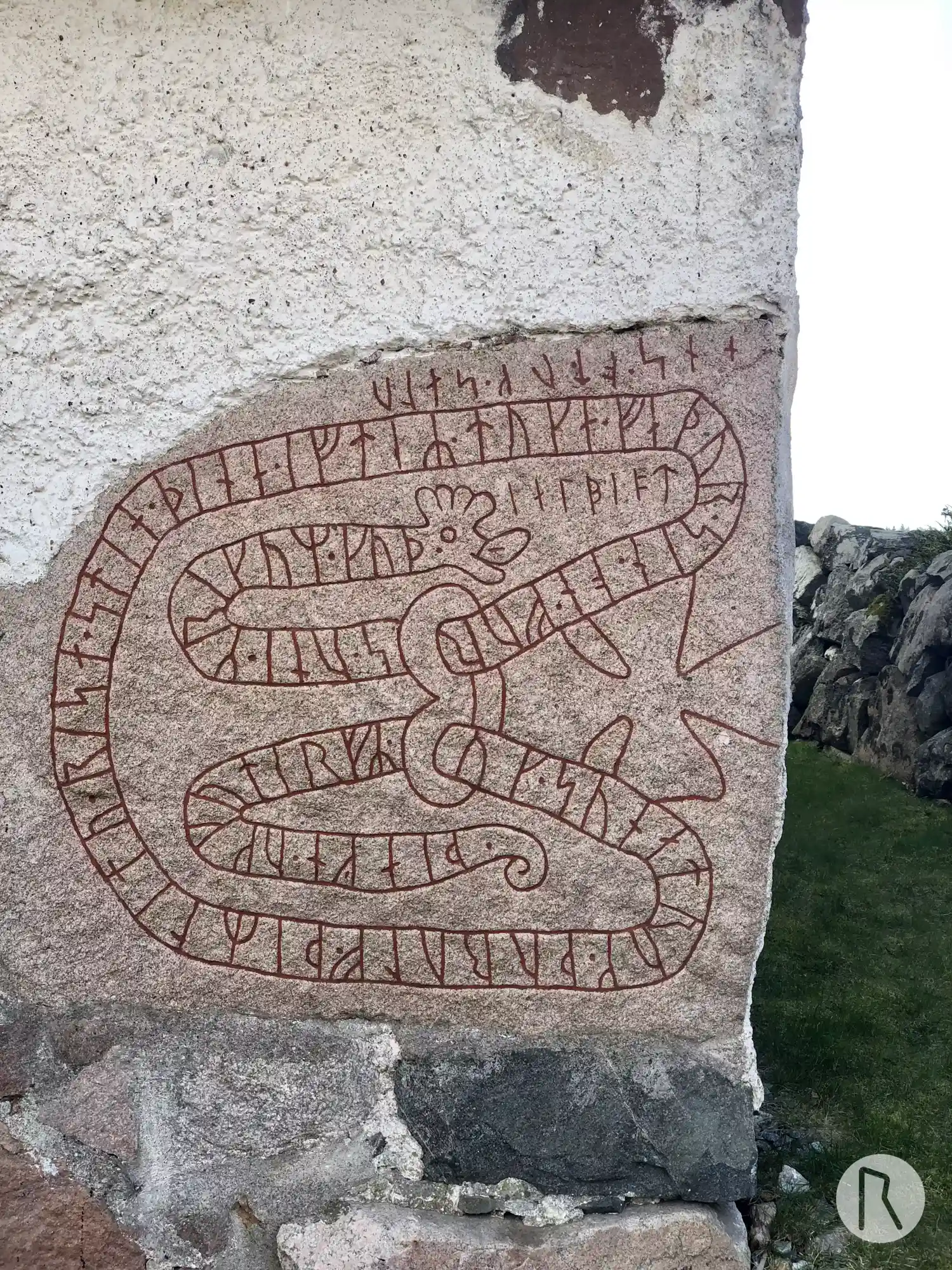
Photo: Niklas Vackerdag
Runic inscription
· þiagn · uk · kutirfR · uk · sunatr · uk · þurulf · þiR · litu · risa · stin · þina · iftiR · tuka · faþur · sin · on · furs · ut i · krikum · kuþ · ialbi ot ans · ot · uk · salu
Inscription
· þiagn · uk · kutirfR · uk · sunatr · uk · þurulf · þiR · litu · risa · stin · þina · iftiR · tuka · faþur · sin · on · furs · ut i · krikum · kuþ · ialbi ot ans · ot · uk · salu
Translation
Þegn and Gautdjarfr(?) and Sunnhvatr(?) and Þórulfr, they had this stone raised in memory of Tóki, their father. He perished abroad in Greece. May God help his spirit, spirit and soul.
Find the carving
Rune-stone U201, L2017:1726 in Angarn parish, Vallentuna municipality
Facts
| Monument number | L2017:1726 |
|---|---|
| Swedish National Heritage Board ID | Angarn 24:1 |
| Carver | Samma som gjort U 276; Gunnar (A) |
| Status | Confirmed on location |
| Place | Visible above ground |
| Material | Granite |
| Period | Viking age |
| Antiquarian assessment | Ancient monument |
| Damage status | Damage |
| County | Stockholm |
| Municipality | Vallentuna |
| Parish | Angarn |
| Coordinates | 59.5366255, 18.1689412 |
Sources
Most of the factual information in Runkartan comes from the Swedish National Heritage Board’s Fornsök data and from the Scandinavian Runic Text Database. The maps come from OpenStreetMap and Leaflet.js. The photographs were taken by the credited photographers.