Rune-stone U117, L2017:800 in Ed parish, Upplands Väsby municipality
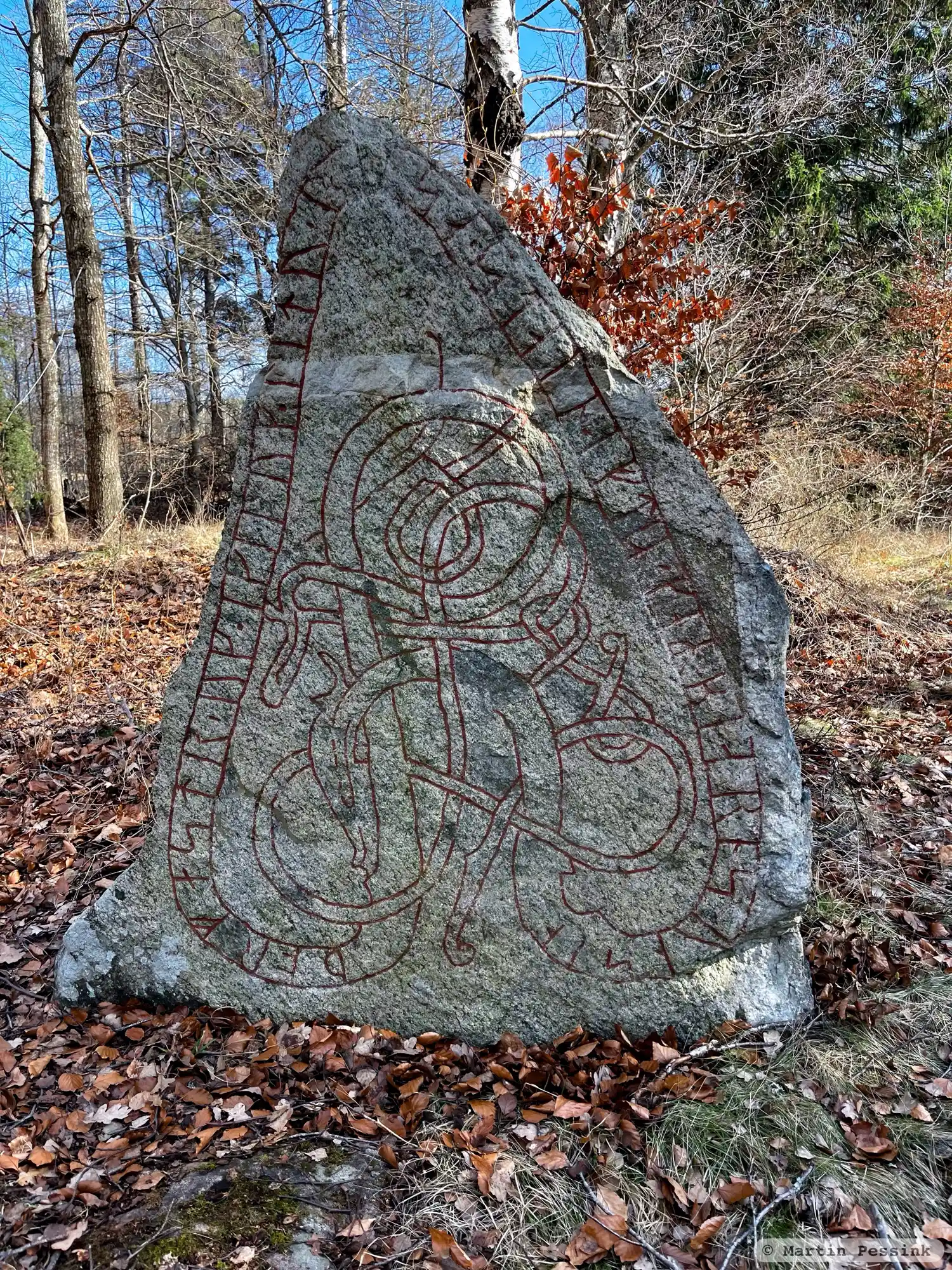
Photo: Martin Pessink
Runic inscription
þorfastr ' uk · ikiluk ' litu ' raisa ' stain ' iftiR ' keRbiarn sun sin
Inscription
þorfastr ' uk · ikiluk ' litu ' raisa ' stain ' iftiR ' keRbiarn sun sin
Translation
Þorfastr and Ingilaug had the stone raised in memory of Geirbjôrn, their son.
Find the carving
Rune-stone U117, L2017:800 in Ed parish, Upplands Väsby municipality
Facts
| Monument number | L2017:800 |
|---|---|
| Swedish National Heritage Board ID | Ed 62:2 |
| Carver | Öpir 1 (A) [Åhlén 1997] |
| Status | Confirmed on location |
| Place | Visible above ground |
| Material | Granite |
| Antiquarian assessment | Ancient monument |
| Damage status | Unknown |
| County | Stockholm |
| Municipality | Upplands Väsby |
| Parish | Ed |
| Coordinates | 59.5026995, 17.8999925 |
Sources
Most of the factual information in Runkartan comes from the Swedish National Heritage Board’s Fornsök data and from the Scandinavian Runic Text Database. The maps come from OpenStreetMap and Leaflet.js. The photographs were taken by the credited photographers.