Rune-stone U142, L2014:425 in Täby parish, Täby municipality
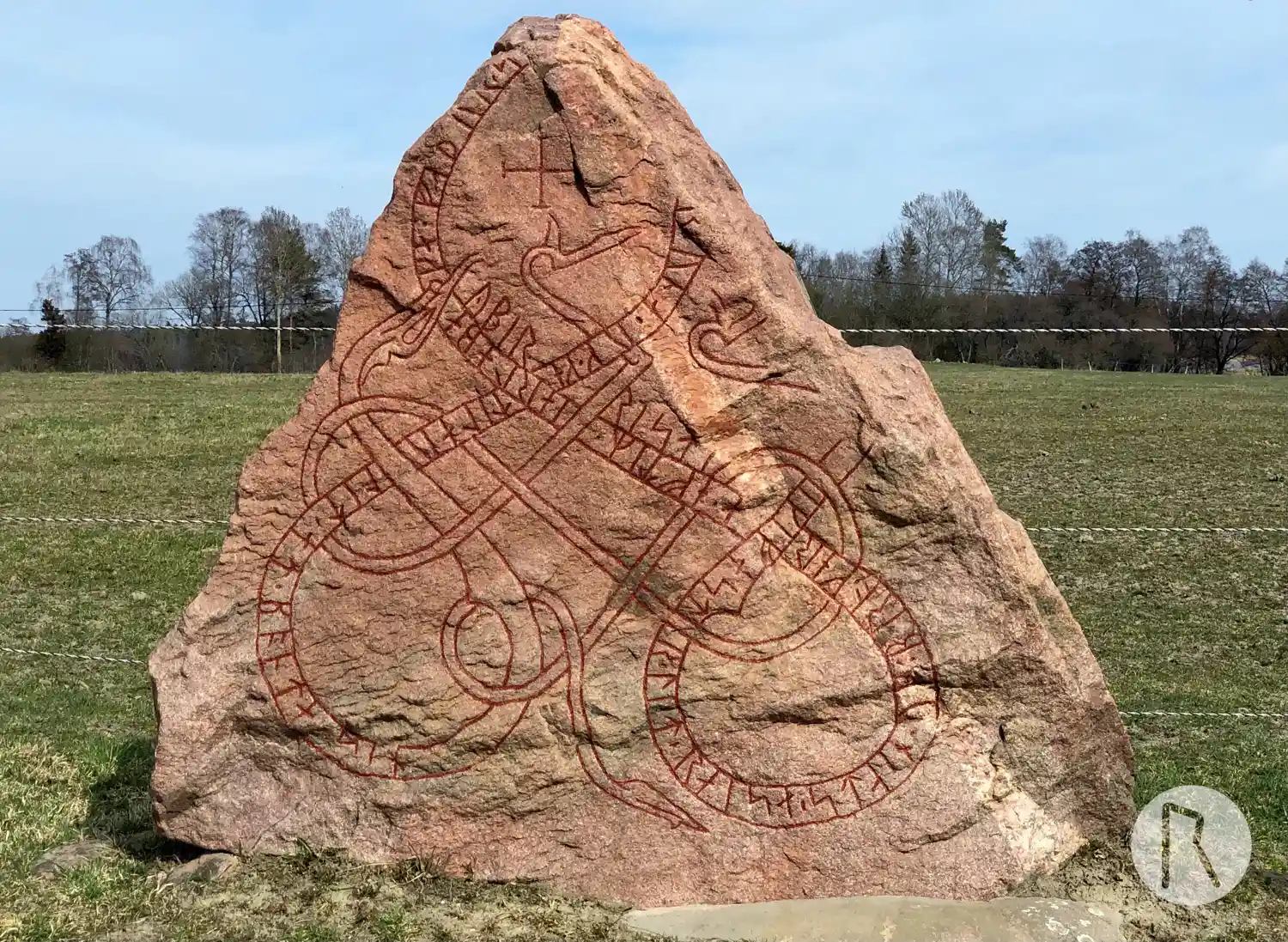
Photo: Niklas Vackerdag
Runic inscription
ikifastr ' lit ' raisa ' stain · uk ' bro ' kera ' eftiR ' iarlabaka ' faþur ' s[in ' uk ' sun ' io]runa ' uk ' ketilau lit ' at ' bonta ' sin ybir risti
Inscription
ikifastr ' lit ' raisa ' stain · uk ' bro ' kera ' eftiR ' iarlabaka ' faþur ' s[in ' uk ' sun ' io]runa ' uk ' ketilau lit ' at ' bonta ' sin ybir risti
Translation
Ingifastr had the stone raised and the bridge made in memory of Jarlabanki, his father, Jórunnr's son. And Ketiley had (it raised/made) in memory of her husbandman. Œpir carved.
Find the carving
Rune-stone U142, L2014:425 in Täby parish, Täby municipality
Facts
| Monument number | L2014:425 |
|---|---|
| Swedish National Heritage Board ID | Täby 44:1 |
| Carver | Öpir 1 (S) |
| Status | Confirmed on location |
| Place | Visible above ground |
| Material | Granite |
| Antiquarian assessment | Ancient monument |
| Damage status | Unknown |
| County | Stockholm |
| Municipality | Täby |
| Parish | Täby |
| Coordinates | 59.481722, 18.01454 |
Sources
Most of the factual information in Runkartan comes from the Swedish National Heritage Board’s Fornsök data and from the Scandinavian Runic Text Database. The maps come from OpenStreetMap and Leaflet.js. The photographs were taken by the credited photographers.