Rune-stone Sö229, L2015:6342 in Sorunda parish, Nynäshamn municipality
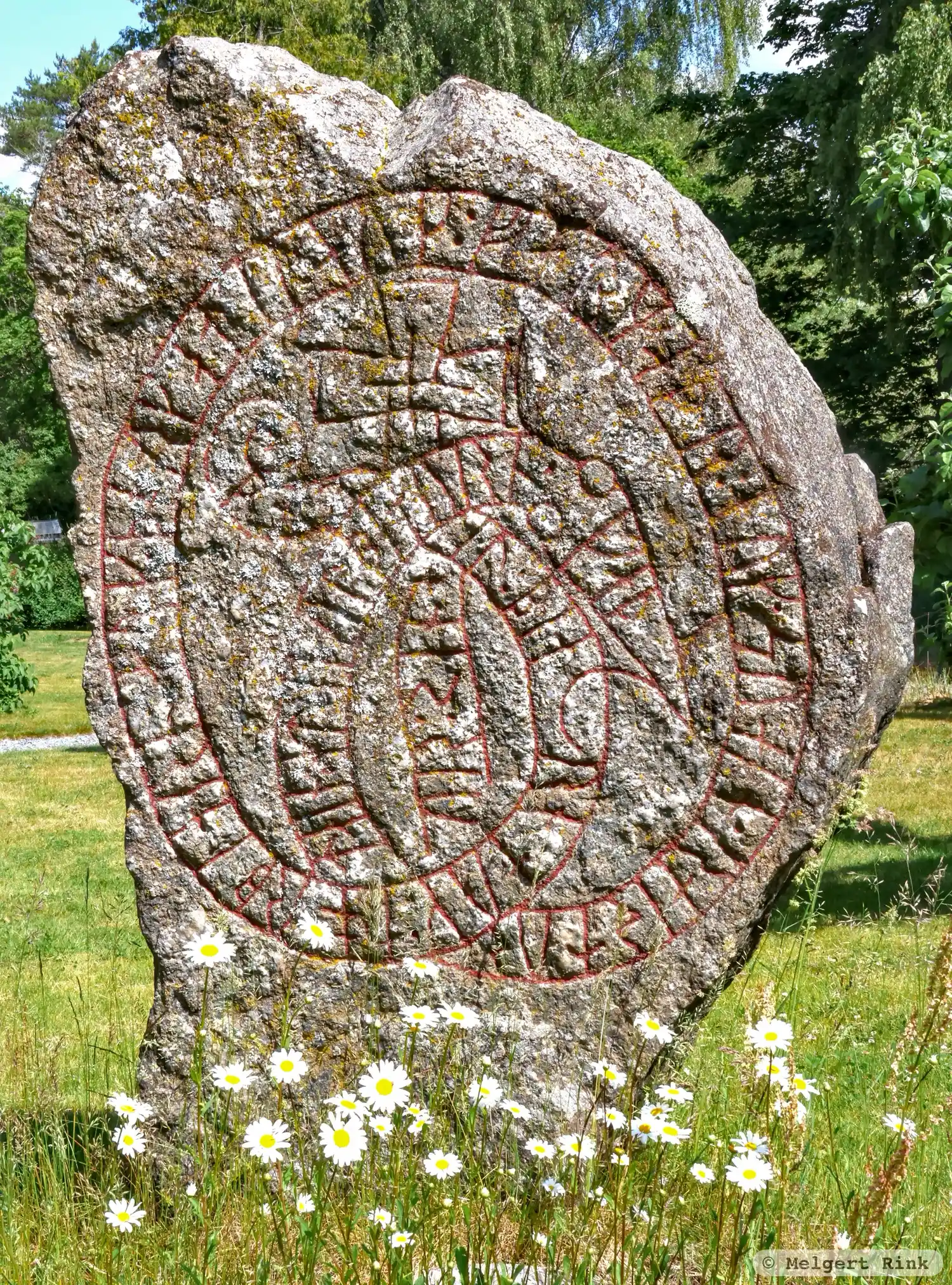
Photo: Melgert Rink
Runic inscription
· katil:biarn : auk : þorbiarn : auk : þorkatil · auk : farmaþr : auk : suain · raistu stain : at · ikulbiaurn · faþur : sin +
Inscription
· katil:biarn : auk : þorbiarn : auk : þorkatil · auk : farmaþr : auk : suain · raistu stain : at · ikulbiaurn · faþur : sin +
Translation
Ketilbjôrn and Þorbjôrn and Þorketill and Farmaðr and Sveinn raised the stone in memory of Ígulbjôrn, their father.
Find the carving
Rune-stone Sö229, L2015:6342 in Sorunda parish, Nynäshamn municipality
Facts
| Monument number | L2015:6342 |
|---|---|
| Swedish National Heritage Board ID | Sorunda 302:1 |
| Carver | Amunde (A) |
| Status | Confirmed on location |
| Place | Visible above ground |
| Antiquarian assessment | Ancient monument |
| Damage status | Unknown |
| County | Stockholm |
| Municipality | Nynäshamn |
| Parish | Sorunda |
| Coordinates | 59.0158855, 17.8204815 |
Sources
Most of the factual information in Runkartan comes from the Swedish National Heritage Board’s Fornsök data and from the Scandinavian Runic Text Database. The maps come from OpenStreetMap and Leaflet.js. The photographs were taken by the credited photographers.