Rune-stone UATA2999/50, L2016:9297 in Skederid parish, Norrtälje municipality
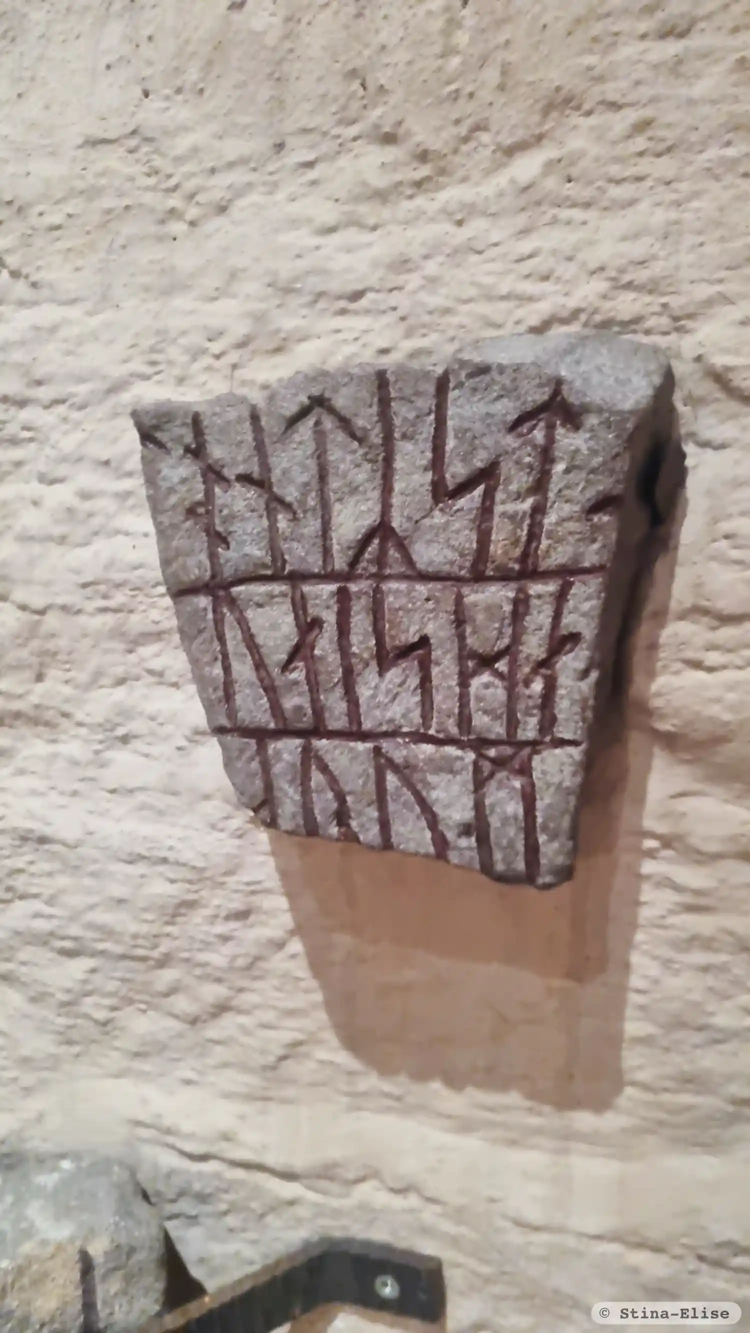
Photo: Stina-Elise
Runic inscription
... sin ... hiona ...
Inscription
... sin ... hiona ...
Translation
... his(?) ... married couple's ...
Find the carving
Rune-stone UATA2999/50, L2016:9297 in Skederid parish, Norrtälje municipality
Facts
| Monument number | L2016:9297 |
|---|---|
| Swedish National Heritage Board ID | Skederid 18:2 |
| Status | Confirmed on location |
| Place | In building or under water |
| Material | Grey sandstone |
| Antiquarian assessment | Ancient monument |
| Damage status | Undamaged |
| County | Stockholm |
| Municipality | Norrtälje |
| Parish | Skederid |
| Coordinates | 59.7330695, 18.501821 |
Sources
Most of the factual information in Runkartan comes from the Swedish National Heritage Board’s Fornsök data and from the Scandinavian Runic Text Database. The maps come from OpenStreetMap and Leaflet.js. The photographs were taken by the credited photographers.