Rune-stone U517, L2016:9298 in Skederid parish, Norrtälje municipality
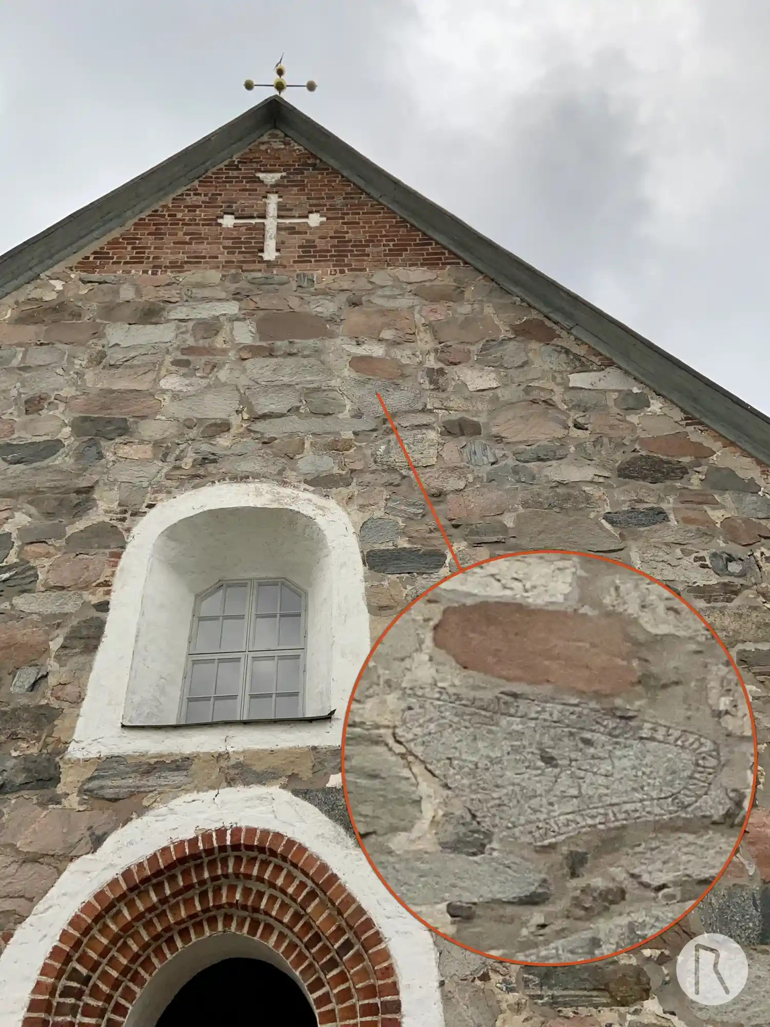
Photo: Niklas Vackerdag
Runic inscription
+ a-... ... ...- + ra---u + stain + eftir haruk + bruþur + sin + in + rakn-... ... ...anta + sin + auk + at suni + ... ... ... ...ar þisi
Inscription
+ a-... ... ...- + ra---u + stain + eftir haruk + bruþur + sin + in + rakn-... ... ...anta + sin + auk + at suni + ... ... ... ...ar þisi
Translation
... (they) raised the stone in memory of Hárukr, their brother; and Ragnhildr(?) ... her husbandman, and in memory of (their) sons ... these runes.
Find the carving
Rune-stone U517, L2016:9298 in Skederid parish, Norrtälje municipality
Facts
| Monument number | L2016:9298 |
|---|---|
| Swedish National Heritage Board ID | Skederid 18:1 |
| Carver | Torbjörn skald (A) [Källström 1999:58ff] |
| Status | Confirmed on location |
| Place | In building or under water |
| Material | Granite |
| Period | Viking age |
| Antiquarian assessment | Ancient monument |
| Damage status | Undamaged |
| County | Stockholm |
| Municipality | Norrtälje |
| Parish | Skederid |
| Coordinates | 59.732997, 18.501533 |
Sources
Most of the factual information in Runkartan comes from the Swedish National Heritage Board’s Fornsök data and from the Scandinavian Runic Text Database. The maps come from OpenStreetMap and Leaflet.js. The photographs were taken by the credited photographers.