Runic inscription U574, L2017:5182 in Estuna parish, Norrtälje municipality
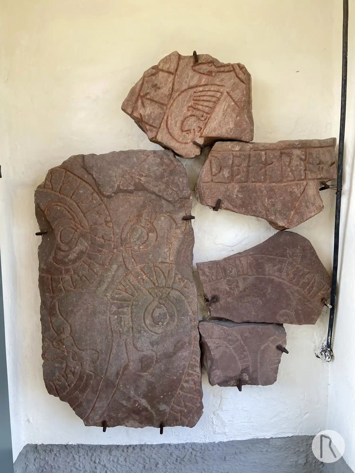
Photo: Niklas Vackerdag
Runic inscription
+ orikia × auk + (þ)(u)-- ---(u) + raisa × ... ...rkiþi × mart a stai... ...(a)-m
Inscription
+ orikia × auk + (þ)(u)-- ---(u) + raisa × ... ...rkiþi × mart a stai... ...(a)-m
Translation
Órœkja and Þóra(?) had raised ... much marked on the stone(?) ...
Find the carving
Runic inscription U574, L2017:5182 in Estuna parish, Norrtälje municipality
Facts
| Monument number | L2017:5182 |
|---|---|
| Swedish National Heritage Board ID | Estuna 32:1 |
| Carver | Vidbjörn (A) [Stille 1999b:139] |
| Status | Confirmed on location |
| Place | Visible above ground |
| Material | Gray-red sandstone |
| Antiquarian assessment | Ancient monument |
| Damage status | Damage |
| County | Stockholm |
| Municipality | Norrtälje |
| Parish | Estuna |
| Coordinates | 59.818258, 18.651395 |
Sources
Most of the factual information in Runkartan comes from the Swedish National Heritage Board’s Fornsök data and from the Scandinavian Runic Text Database. The maps come from OpenStreetMap and Leaflet.js. The photographs were taken by the credited photographers.