Rune-stone Sö237, L2014:4326 in Västerhaninge parish, Haninge municipality
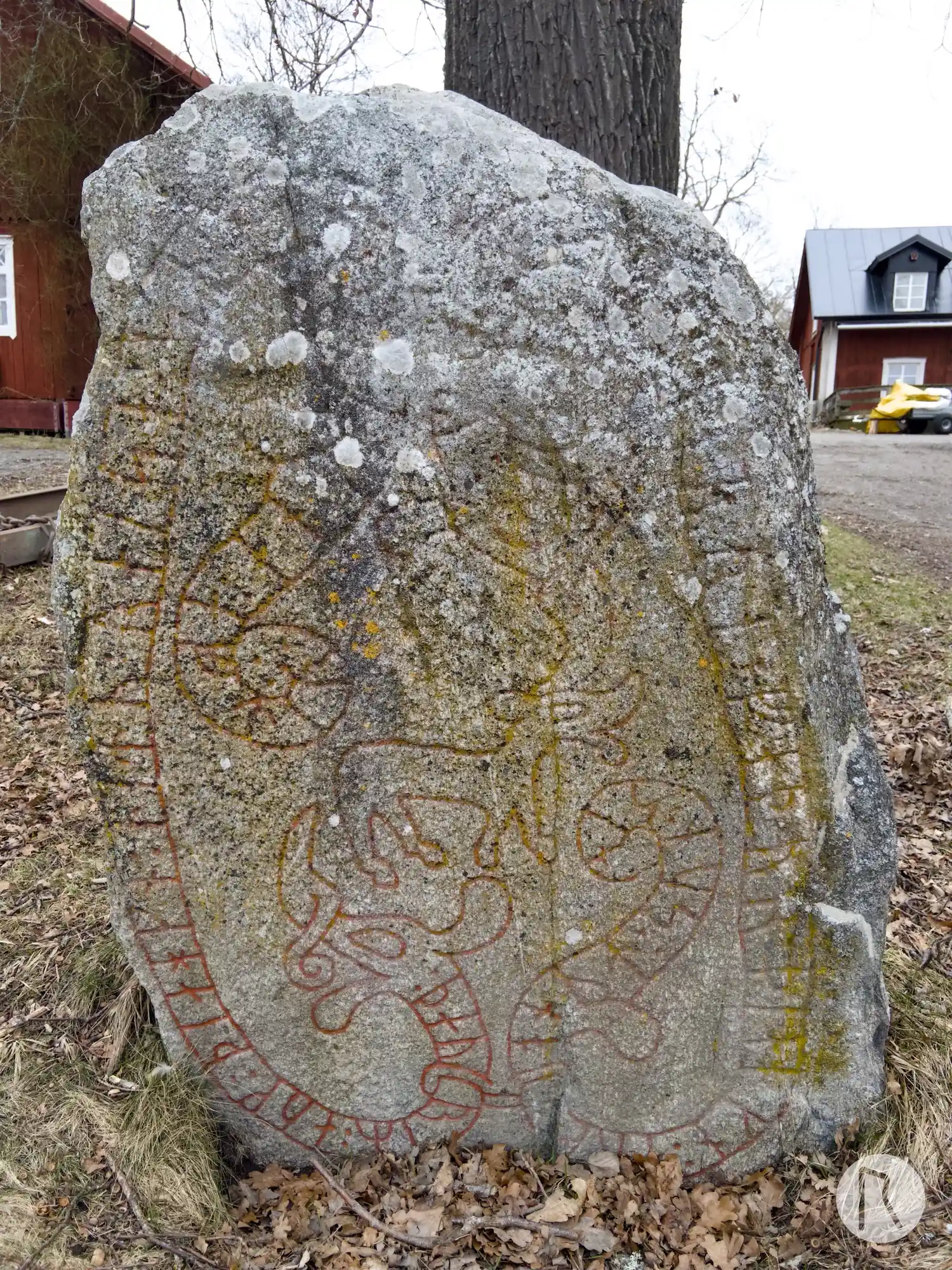
Photo: Niklas Vackerdag
Runic inscription
: þauriR : auk : þiahkn : litu : raiso : stain : þina : aftir :: fastbiaurn : faþur : þiahkn : auk : onut : sun : sin
Inscription
: þauriR : auk : þiahkn : litu : raiso : stain : þina : aftir :: fastbiaurn : faþur : þiahkn : auk : onut : sun : sin
Translation
Þórir and Þegn had this stone raised in memory of Fastbjôrn, Þegn's father, and Ônundr, their son.
Find the carving
Rune-stone Sö237, L2014:4326 in Västerhaninge parish, Haninge municipality
Facts
| Monument number | L2014:4326 |
|---|---|
| Swedish National Heritage Board ID | Västerhaninge 259:1 |
| Carver | Halvdan (A) |
| Status | Confirmed on location |
| Place | Visible above ground |
| Antiquarian assessment | Ancient monument |
| Damage status | Undamaged |
| County | Stockholm |
| Municipality | Haninge |
| Parish | Västerhaninge |
| Coordinates | 59.1025, 18.115725 |
Sources
Most of the factual information in Runkartan comes from the Swedish National Heritage Board’s Fornsök data and from the Scandinavian Runic Text Database. The maps come from OpenStreetMap and Leaflet.js. The photographs were taken by the credited photographers.