Rune-stone U50, L2016:5448 in Lovö parish, Ekerö municipality
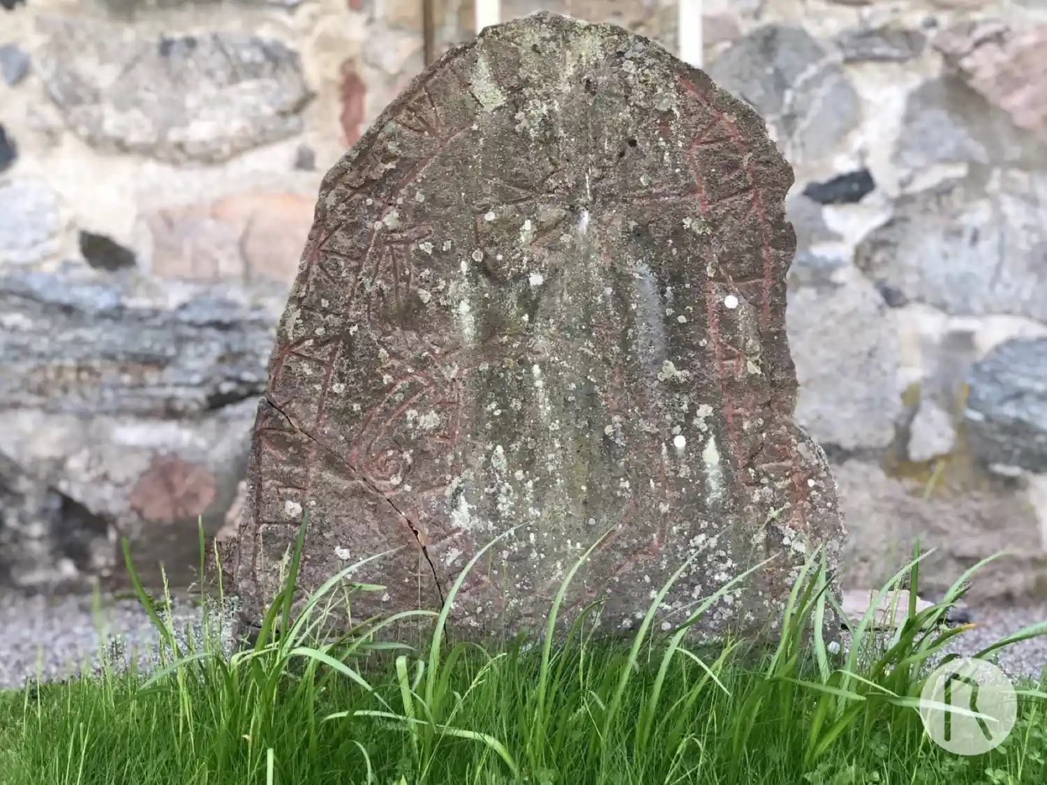
Photo: Niklas Vackerdag
Runic inscription
+ iuan · stretn + merki + ok + rahnuor + eftiri boanta +
Inscription
+ iuan · stretn + merki + ok + rahnuor + eftiri boanta +
Translation
Jóhan the pugnacious(?) landmark; and Ragnvôr in memory of (her) husbandman.
Find the carving
Rune-stone U50, L2016:5448 in Lovö parish, Ekerö municipality
Facts
| Monument number | L2016:5448 |
|---|---|
| Swedish National Heritage Board ID | Lovö 38:1 |
| Carver | Samma som gjort U 49. |
| Status | Confirmed on location |
| Place | Visible above ground |
| Material | Sandstone |
| Antiquarian assessment | Ancient monument |
| Damage status | Unknown |
| County | Stockholm |
| Municipality | Ekerö |
| Parish | Lovö |
| Coordinates | 59.321362, 17.83968 |
Sources
Most of the factual information in Runkartan comes from the Swedish National Heritage Board’s Fornsök data and from the Scandinavian Runic Text Database. The maps come from OpenStreetMap and Leaflet.js. The photographs were taken by the credited photographers.