Rune-stone Sö184, L1985:8552 in Kärnbo parish, Strängnäs municipality
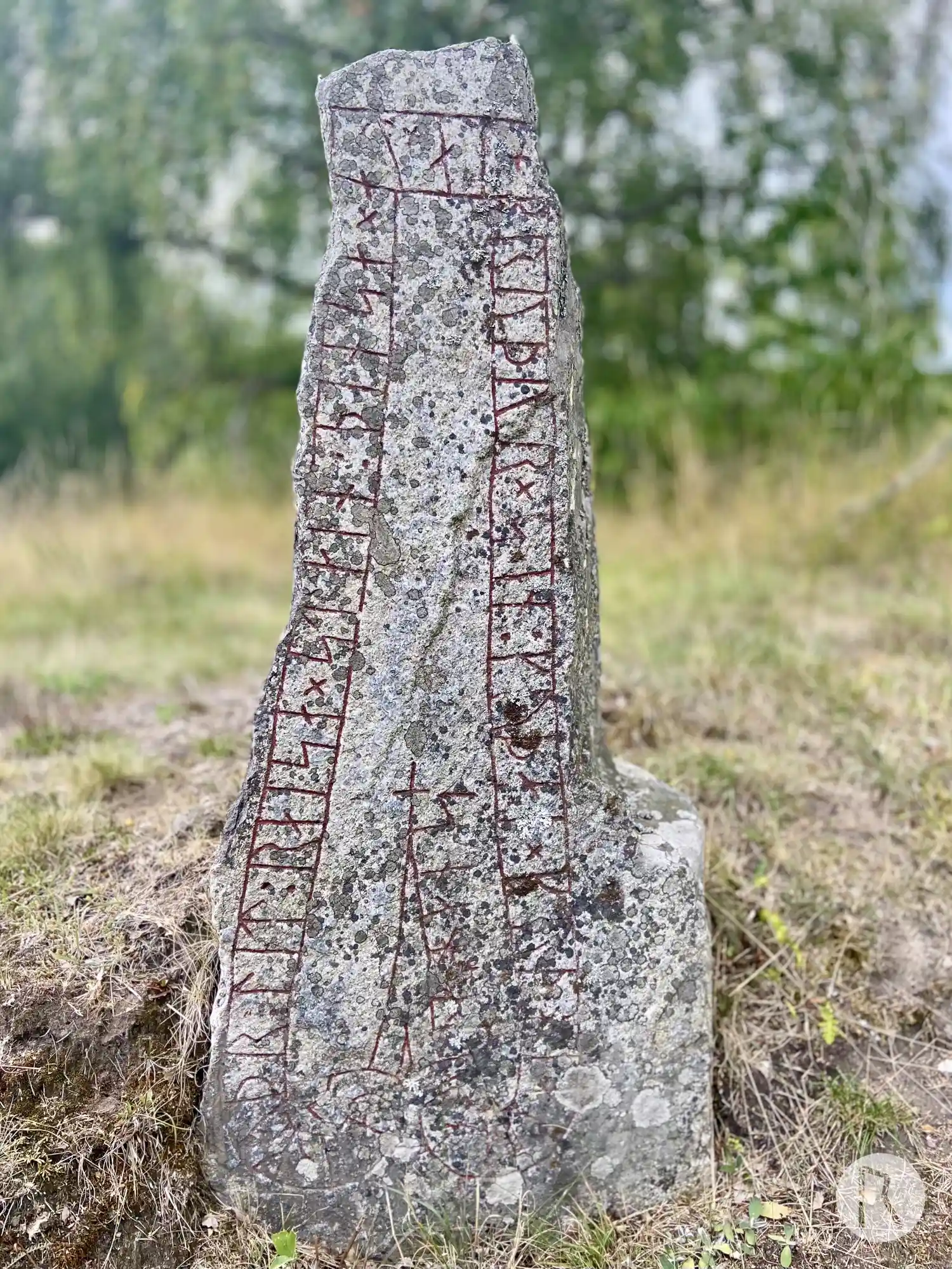
Photo: Niklas Vackerdag
Runic inscription
hermuþr : lit : raisa × stain : þinsa × at × al + bruþur × sin : kuþan × kuþ hialbi anta + hans
Inscription
hermuþr : lit : raisa × stain : þinsa × at × al + bruþur × sin : kuþan × kuþ hialbi anta + hans
Translation
Hermóðr had this stone raised in memory of Hallr(?), his good brother. May God help his spirit.
Find the carving
Rune-stone Sö184, L1985:8552 in Kärnbo parish, Strängnäs municipality
Facts
| Monument number | L1985:8552 |
|---|---|
| Swedish National Heritage Board ID | Kärnbo 7:4 |
| Status | Confirmed on location |
| Place | Visible above ground |
| Material | Granite |
| Antiquarian assessment | Ancient monument |
| Damage status | Undamaged |
| County | Södermanland |
| Municipality | Strängnäs |
| Parish | Kärnbo |
| Coordinates | 59.261608, 17.167213 |
Sources
Most of the factual information in Runkartan comes from the Swedish National Heritage Board’s Fornsök data and from the Scandinavian Runic Text Database. The maps come from OpenStreetMap and Leaflet.js. The photographs were taken by the credited photographers.