Rune-stone Sö103, L1985:8844 in Jäder parish, Eskilstuna municipality
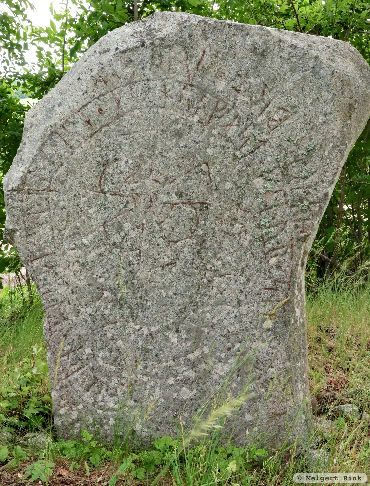
Photo: Melgert Rink
Runic inscription
: biurn · kirþi · kuml · þisa · at · hulfast · faþur · sin · auk ·· iarl · broþur · sin ·
Inscription
: biurn · kirþi · kuml · þisa · at · hulfast · faþur · sin · auk ·· iarl · broþur · sin ·
Translation
Bjôrn made these monuments in memory of Holmfastr, his father and Jarl, his brother.
Find the carving
Rune-stone Sö103, L1985:8844 in Jäder parish, Eskilstuna municipality
Facts
| Monument number | L1985:8844 |
|---|---|
| Swedish National Heritage Board ID | Jäder 110:1 |
| Status | Confirmed on location |
| Place | Visible above ground |
| Material | Granite |
| Period | Viking age |
| Antiquarian assessment | Ancient monument |
| Damage status | Undamaged |
| County | Södermanland |
| Municipality | Eskilstuna |
| Parish | Jäder |
| Coordinates | 59.4382385, 16.7139835 |
Sources
Most of the factual information in Runkartan comes from the Swedish National Heritage Board’s Fornsök data and from the Scandinavian Runic Text Database. The maps come from OpenStreetMap and Leaflet.js. The photographs were taken by the credited photographers.