Rune-stone Sö102, L1985:8150 in Jäder parish, Eskilstuna municipality
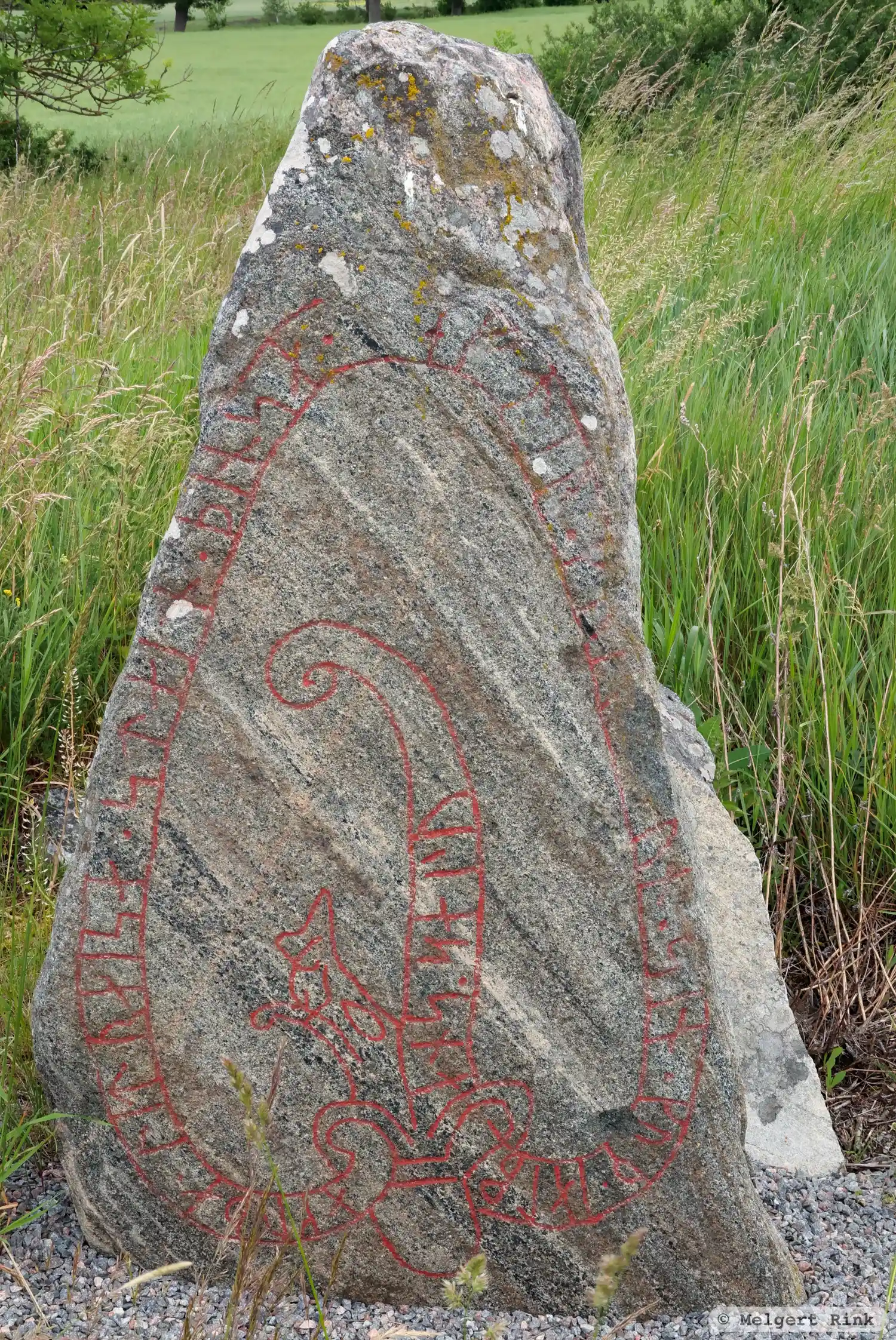
Photo: Melgert Rink
Runic inscription
omuþa · lit · raisa · stain · þinsa · eftir · ku[na]... sun · sin · kuþ · ialbi ans · (s)alu
Inscription
omuþa · lit · raisa · stain · þinsa · eftir · ku[na]... sun · sin · kuþ · ialbi ans · (s)alu
Translation
Ámóða had this stone raised in memory of Gunni/Gunnarr, his son. May God help his soul.
Find the carving
Rune-stone Sö102, L1985:8150 in Jäder parish, Eskilstuna municipality
Facts
| Monument number | L1985:8150 |
|---|---|
| Swedish National Heritage Board ID | Jäder 108:1 |
| Status | Confirmed on location |
| Place | Visible above ground |
| Material | Gneiss |
| Period | Viking age |
| Antiquarian assessment | Ancient monument |
| Damage status | Undamaged |
| County | Södermanland |
| Municipality | Eskilstuna |
| Parish | Jäder |
| Coordinates | 59.4418815, 16.718713 |
Sources
Most of the factual information in Runkartan comes from the Swedish National Heritage Board’s Fornsök data and from the Scandinavian Runic Text Database. The maps come from OpenStreetMap and Leaflet.js. The photographs were taken by the credited photographers.