Rune-stone DR321, L1989:7846 in Västra Karaby parish, Kävlinge municipality
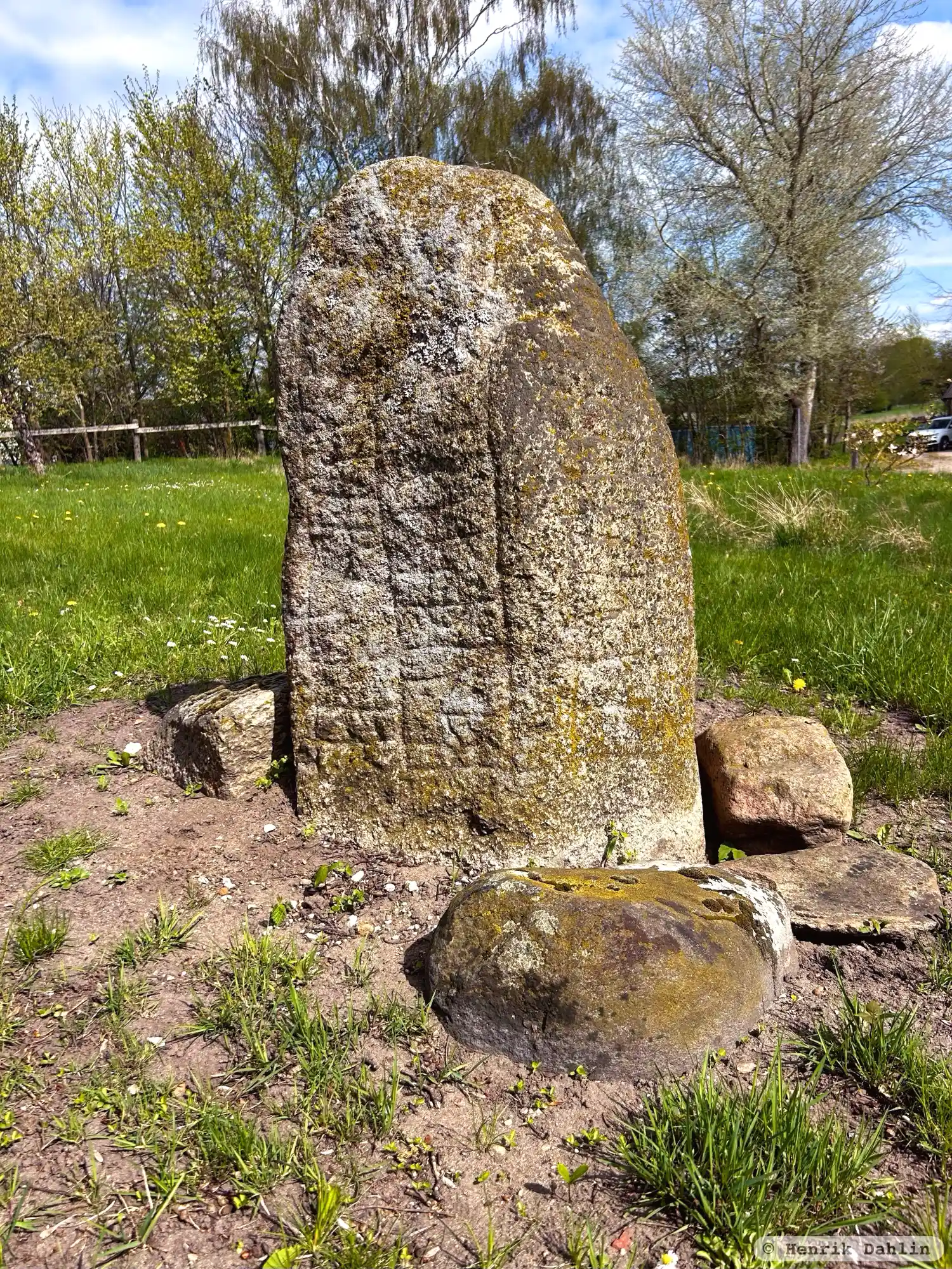
Photo: Henrik Dahlin
Runic inscription
§A : hals : auk : frebiurn : risþu : st¶ina §B : þesi : eftiR : ¶ hufa : felaga : ¶ sin :
Inscription
§A : hals : auk : frebiurn : risþu : st¶ina §B : þesi : eftiR : ¶ hufa : felaga : ¶ sin :
Translation
§A Hals and Freybjôrn raised these stones §B in memory of Hofi, their partner.
Find the carving
Rune-stone DR321, L1989:7846 in Västra Karaby parish, Kävlinge municipality
Facts
| Monument number | L1989:7846 |
|---|---|
| Swedish National Heritage Board ID | Västra Karaby 10:1 |
| Status | Confirmed on location |
| Place | Visible above ground |
| Material | Granite |
| Period | Viking age |
| Antiquarian assessment | Ancient monument |
| Damage status | Unknown |
| County | Skåne |
| Municipality | Kävlinge |
| Parish | Västra Karaby |
| Coordinates | 55.8222795, 12.999781 |
Sources
Most of the factual information in Runkartan comes from the Swedish National Heritage Board’s Fornsök data and from the Scandinavian Runic Text Database. The maps come from OpenStreetMap and Leaflet.js. The photographs were taken by the credited photographers.