Rune-stone ÖgNOR1994;27, L2011:6015 in Skärkind parish, Norrköping municipality
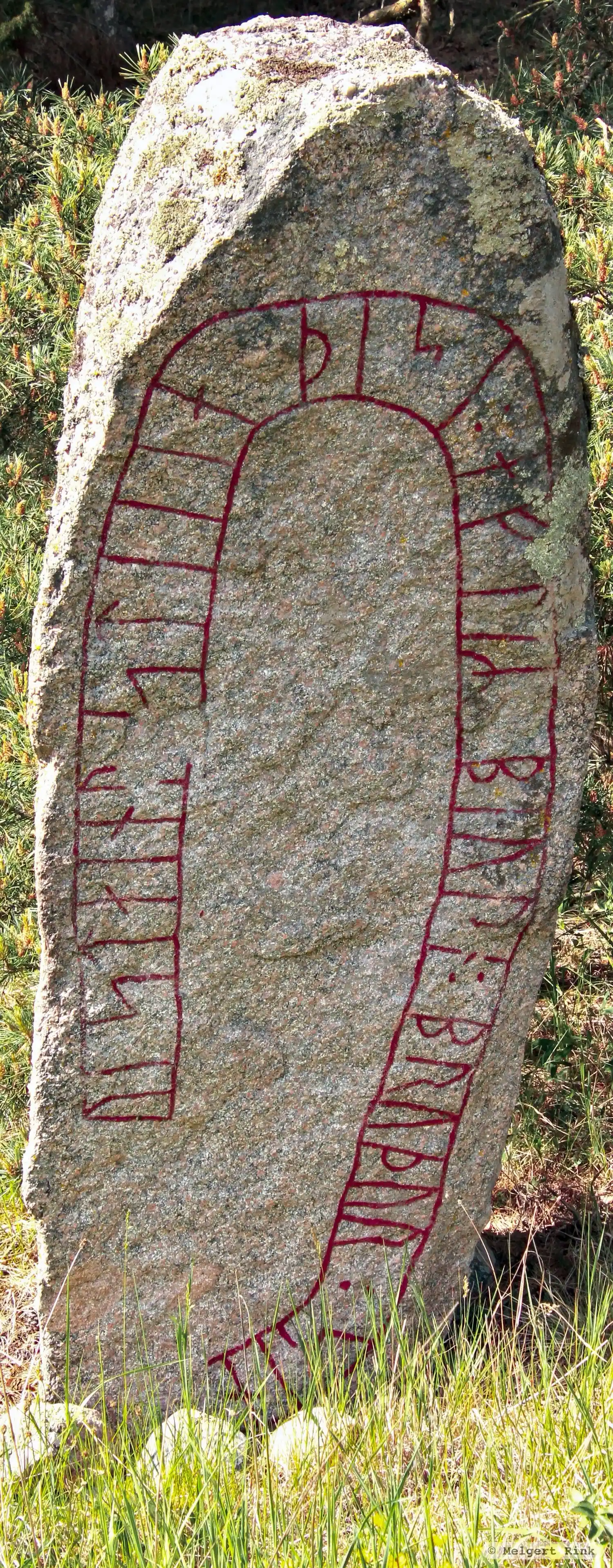
Photo: Melgert Rink
Runic inscription
uistain rsti --a þ-s- : aftiR biurn : bruþur : sin
Inscription
uistain rsti --a þ-s- : aftiR biurn : bruþur : sin
Translation
Vésteinn raised ... in memory of Bjôrn, his brother.
Find the carving
Rune-stone ÖgNOR1994;27, L2011:6015 in Skärkind parish, Norrköping municipality
Facts
| Monument number | L2011:6015 |
|---|---|
| Swedish National Heritage Board ID | Skärkind 401:1 |
| Status | Confirmed on location |
| Place | Visible above ground |
| Material | Granite |
| Antiquarian assessment | Ancient monument |
| Damage status | Damage |
| County | Östergötland |
| Municipality | Norrköping |
| Parish | Skärkind |
| Coordinates | 58.4819885, 15.9793505 |
Sources
Most of the factual information in Runkartan comes from the Swedish National Heritage Board’s Fornsök data and from the Scandinavian Runic Text Database. The maps come from OpenStreetMap and Leaflet.js. The photographs were taken by the credited photographers.