Rune-stone Ög96, L2010:9787 in Väderstad parish, Mjölby municipality
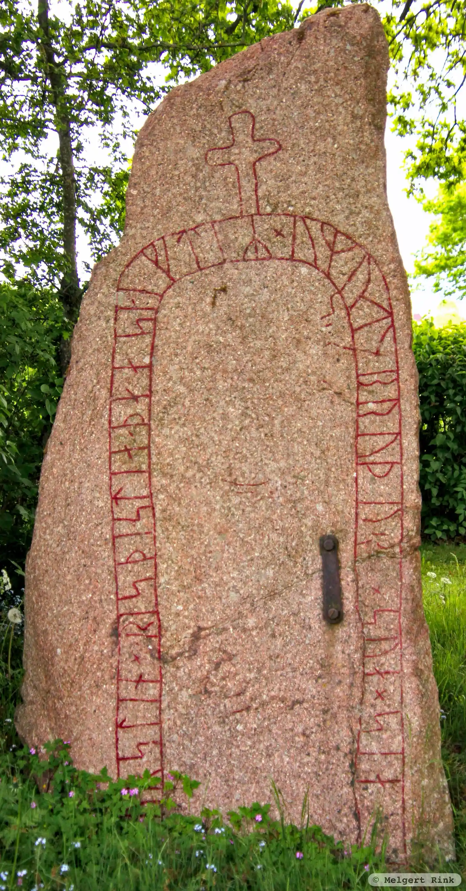
Photo: Melgert Rink
Runic inscription
þurstin × risþi [× s]tia × þaasi × eftiR × ymut × bruþu[r×]sua × sia
Inscription
þurstin × risþi [× s]tia × þaasi × eftiR × ymut × bruþu[r×]sua × sia
Translation
Þorsteinn raised this stone in memory of Eymundr, his brother's son.
Find the carving
Rune-stone Ög96, L2010:9787 in Väderstad parish, Mjölby municipality
Facts
| Monument number | L2010:9787 |
|---|---|
| Swedish National Heritage Board ID | Väderstad 5:1 |
| Status | Confirmed on location |
| Place | Visible above ground |
| Antiquarian assessment | Ancient monument |
| Damage status | Undamaged |
| County | Östergötland |
| Municipality | Mjölby |
| Parish | Väderstad |
| Coordinates | 58.3282625, 14.9177155 |
Sources
Most of the factual information in Runkartan comes from the Swedish National Heritage Board’s Fornsök data and from the Scandinavian Runic Text Database. The maps come from OpenStreetMap and Leaflet.js. The photographs were taken by the credited photographers.