Rune-stone Helleröstenen, L2023:3035 in Västra Ed parish, Västervik municipality
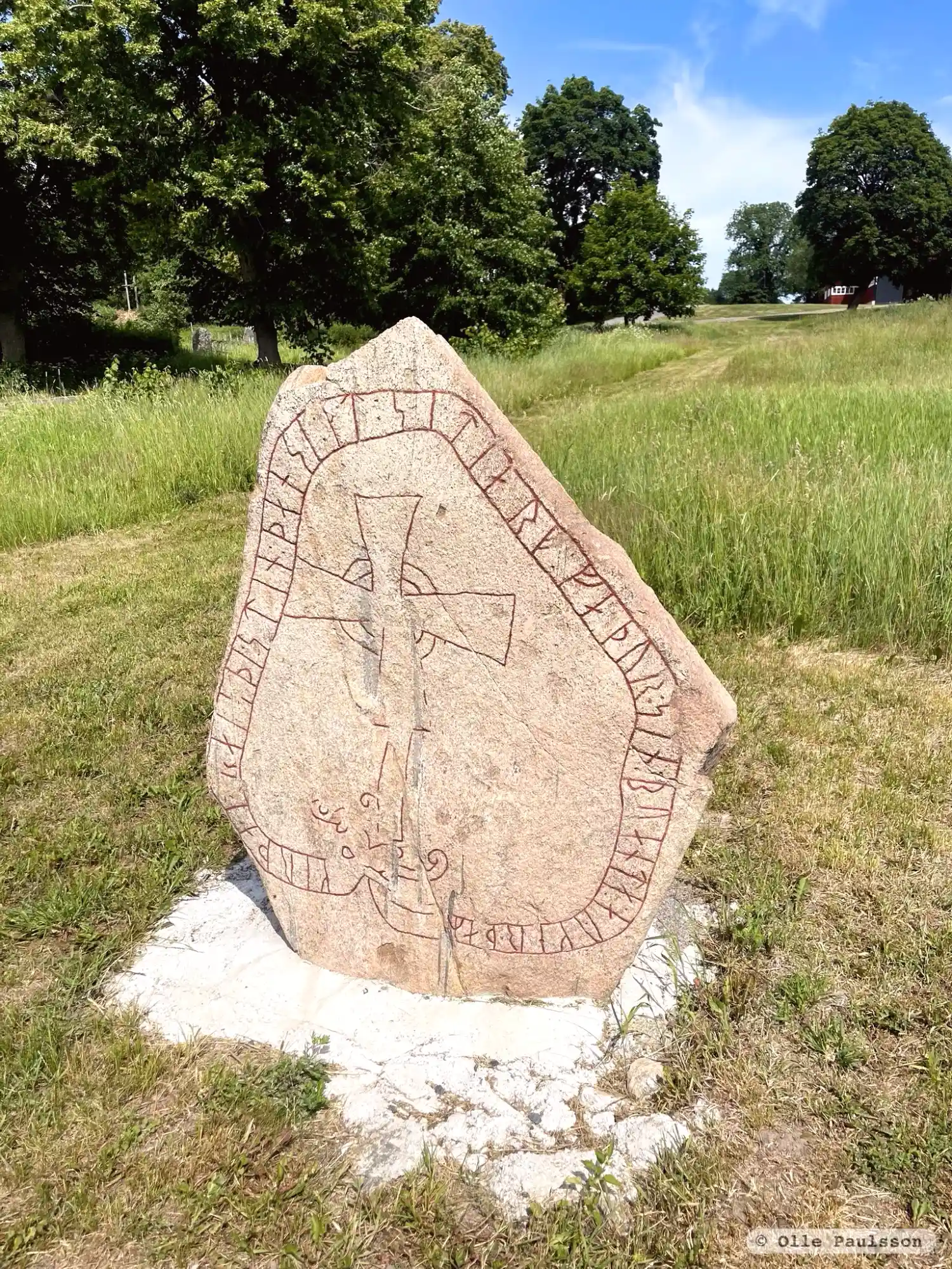
Photo: Olle Paulsson
Runic inscription
kerþa!r raisþi : stin : þansi : at : sitiarf * faþur : sin : buanta : aykerþaR Gerðarr ræisþi stæin þannsi at Sigdiarf, faður sin, bōanda Øygærðaʀ.
Inscription
kerþa!r raisþi : stin : þansi : at : sitiarf * faþur : sin : buanta : aykerþaR Gerðarr ræisþi stæin þannsi at Sigdiarf, faður sin, bōanda Øygærðaʀ.
Translation
Gärdar had this stone raised in memory of Sigdjärv, his father, husband of Ögärd.
Find the carving
Rune-stone Helleröstenen, L2023:3035 in Västra Ed parish, Västervik municipality
Facts
| Monument number | L2023:3035 |
|---|---|
| Status | Confirmed on location |
| Place | Visible above ground |
| Antiquarian assessment | Ancient monument |
| Damage status | Undamaged |
| County | Kalmar |
| Municipality | Västervik |
| Parish | Västra Ed |
| Coordinates | 57.9695325, 16.628935 |
Sources
Most of the factual information in Runkartan comes from the Swedish National Heritage Board’s Fornsök data and from the Scandinavian Runic Text Database. The maps come from OpenStreetMap and Leaflet.js. The photographs were taken by the credited photographers.