Rune-stone Sm73, L1972:1757 in Skepperstad parish, Sävsjö municipality
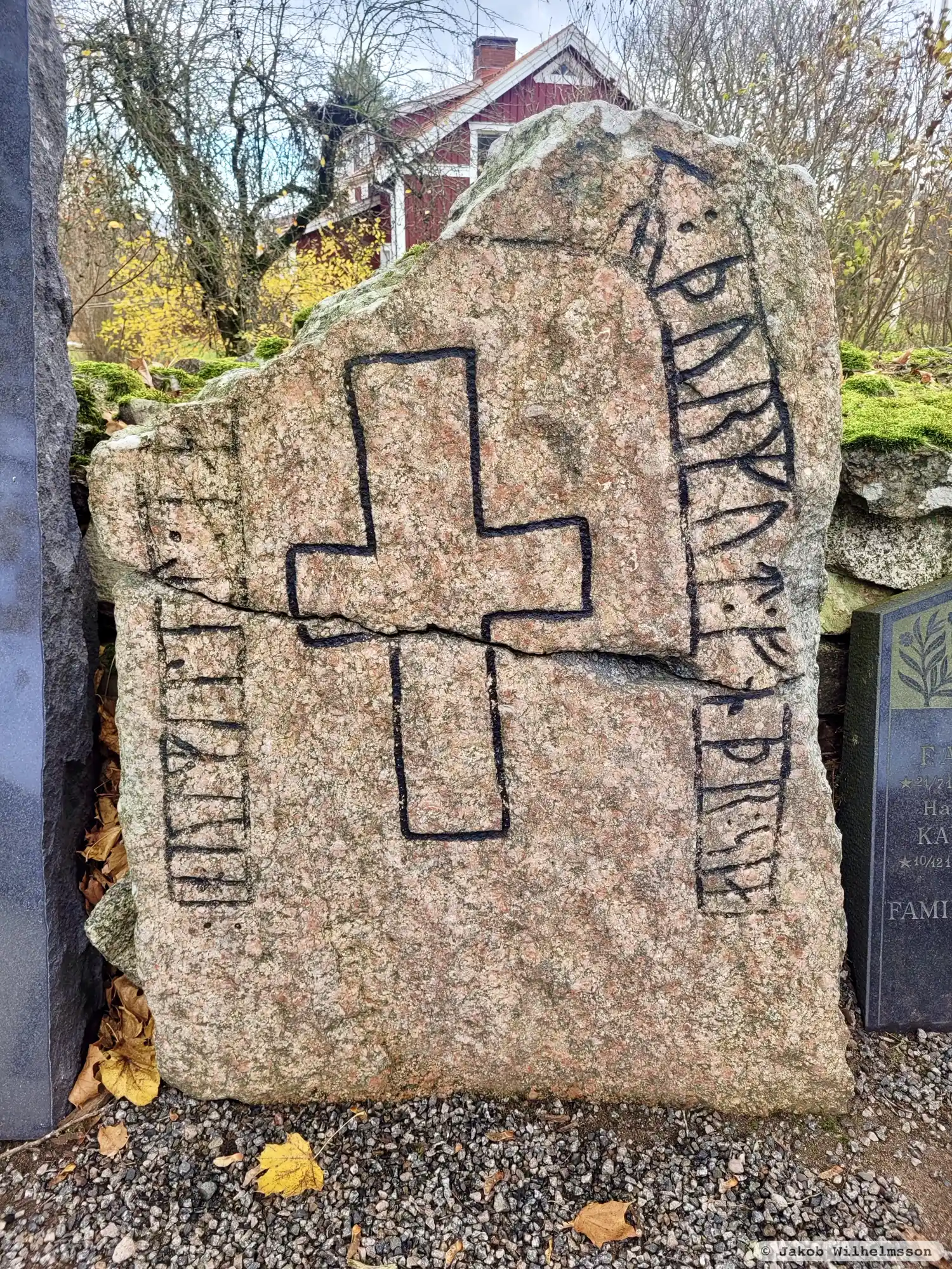
Photo: Jakob Wilhelmsson
Runic inscription
: hulmi : let : ka[ra : bro : ift]R : þurkut : fnþr : sia
Inscription
: hulmi : let : ka[ra : bro : ift]R : þurkut : fnþr : sia
Translation
Holmi had the bridge made in memory of Þorgautr, his father.
Find the carving
Rune-stone Sm73, L1972:1757 in Skepperstad parish, Sävsjö municipality
Facts
| Monument number | L1972:1757 |
|---|---|
| Swedish National Heritage Board ID | Skepperstad 26:1 |
| Status | Confirmed on location |
| Place | Visible above ground |
| Material | Red gneissic eye granite |
| Antiquarian assessment | Ancient monument |
| Damage status | Damage |
| County | Jönköping |
| Municipality | Sävsjö |
| Parish | Skepperstad |
| Coordinates | 57.3505595, 14.7653365 |
Sources
Most of the factual information in Runkartan comes from the Swedish National Heritage Board’s Fornsök data and from the Scandinavian Runic Text Database. The maps come from OpenStreetMap and Leaflet.js. The photographs were taken by the credited photographers.