Rune-stone Gs1, L1950:2410 in Österfärnebo parish, Sandviken municipality
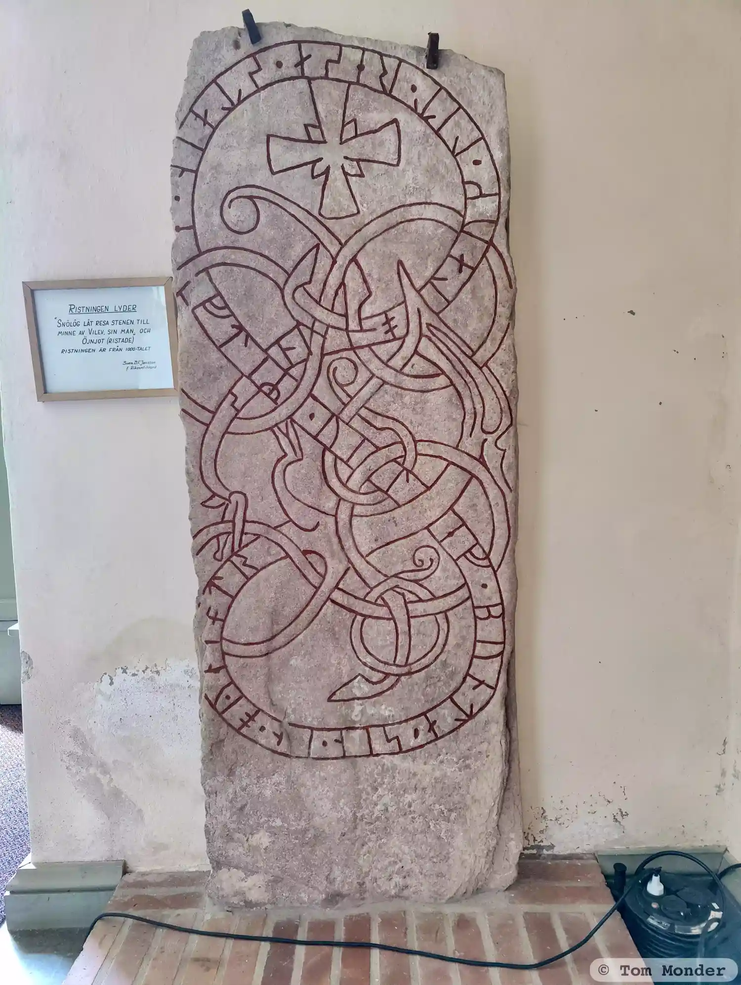
Photo: Tom Monder
Runic inscription
sniolauk · lit · resa · stain · (e)ftiR · uilef · bunta · sin · in · oyniotr
Inscription
sniolauk · lit · resa · stain · (e)ftiR · uilef · bunta · sin · in · oyniotr
Translation
Snjólaug had the stone raised in memory of Véleifr, her husbandman. And Eynjótr (carved?).
Find the carving
Rune-stone Gs1, L1950:2410 in Österfärnebo parish, Sandviken municipality
Facts
| Monument number | L1950:2410 |
|---|---|
| Swedish National Heritage Board ID | Österfärnebo 2:1 |
| Carver | Önjut (S) |
| Status | Confirmed on location |
| Place | Visible above ground |
| Material | Grey sandstone |
| Antiquarian assessment | Ancient monument |
| Damage status | Damage |
| County | Gävleborg |
| Municipality | Sandviken |
| Parish | Österfärnebo |
| Coordinates | 60.3021295, 16.7944315 |
Sources
Most of the factual information in Runkartan comes from the Swedish National Heritage Board’s Fornsök data and from the Scandinavian Runic Text Database. The maps come from OpenStreetMap and Leaflet.js. The photographs were taken by the credited photographers.