Rune-stone Vg150, L1963:1408 in Väne-Åsaka parish, Trollhättan municipality
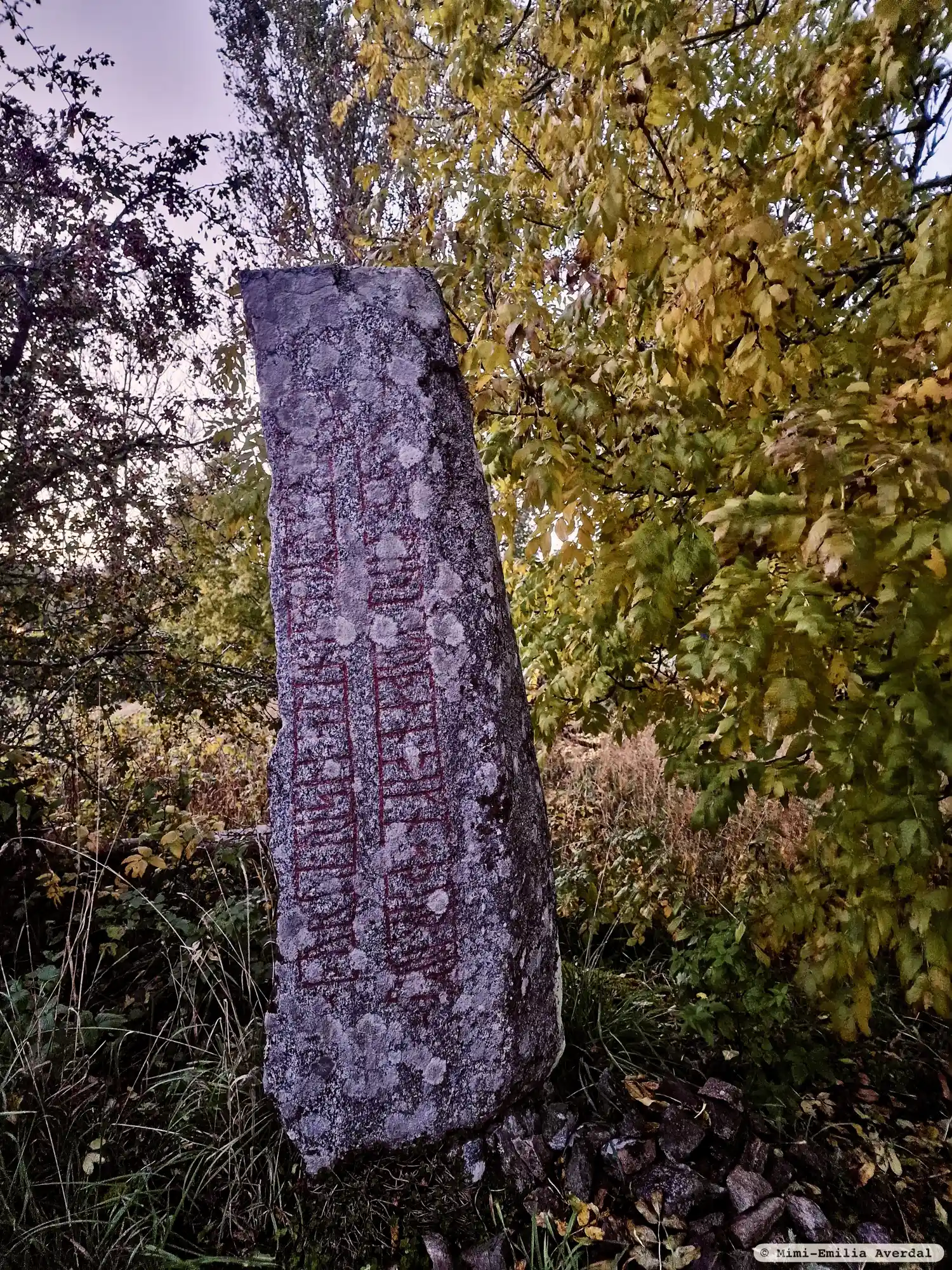
Photo: Mimi-Emilia Averdal
Runic inscription
× þurui : risþi : stin : iftiR : ukmut : buta : sin : miuk : kuþan : þikn × þur : uiki ×
Inscription
× þurui : risþi : stin : iftiR : ukmut : buta : sin : miuk : kuþan : þikn × þur : uiki ×
Translation
Þyrvé raised the stone in memory of Ôgmundr, her husbandman, a very good Þegn. May Þórr hallow.
Find the carving
Rune-stone Vg150, L1963:1408 in Väne-Åsaka parish, Trollhättan municipality
Facts
| Monument number | L1963:1408 |
|---|---|
| Swedish National Heritage Board ID | Väne-Åsaka 8:1 |
| Status | Confirmed on location |
| Place | Visible above ground |
| Antiquarian assessment | Ancient monument |
| Damage status | Unknown |
| County | Västra Götaland |
| Municipality | Trollhättan |
| Parish | Väne-Åsaka |
| Coordinates | 58.2166425, 12.4244225 |
Sources
Most of the factual information in Runkartan comes from the Swedish National Heritage Board’s Fornsök data and from the Scandinavian Runic Text Database. The maps come from OpenStreetMap and Leaflet.js. The photographs were taken by the credited photographers.