Rune-stone U504, L2016:4314 in Närtuna parish, Norrtälje municipality
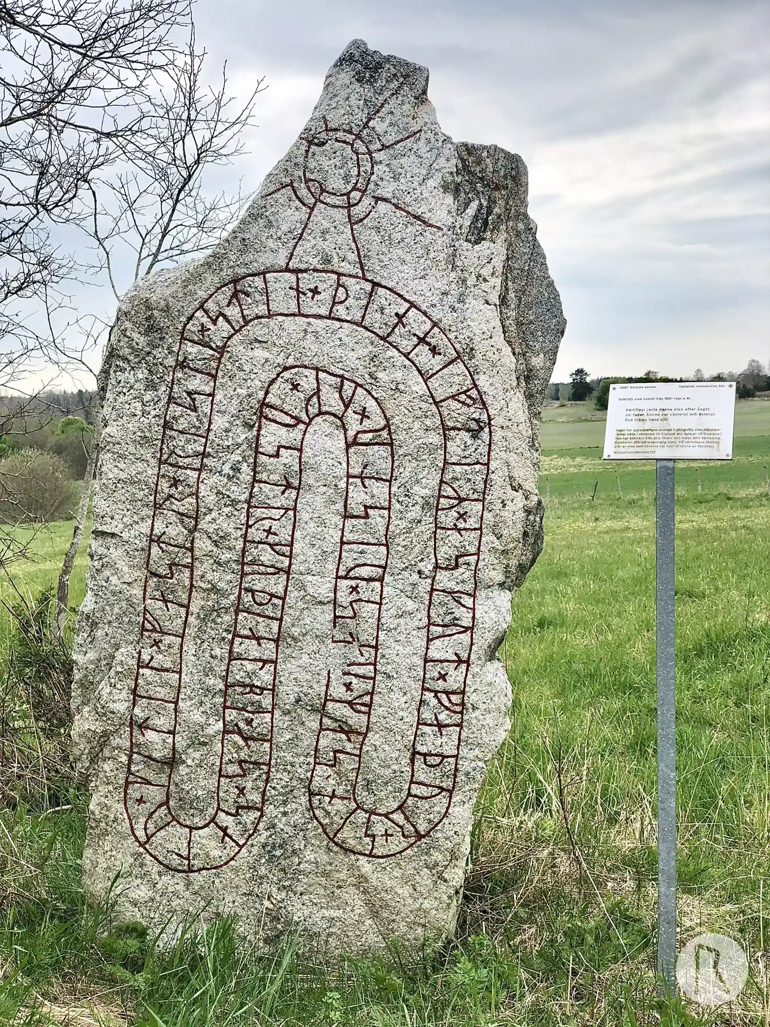
Photo: Niklas Vackerdag
Runic inscription
+ kitil×fastr × risti × stin + þina × iftiR × askut × faþur + sin × saR × uas × uistr × uk × ustr + kuþ ialbi × as × salu
Inscription
+ kitil×fastr × risti × stin + þina × iftiR × askut × faþur + sin × saR × uas × uistr × uk × ustr + kuþ ialbi × as × salu
Translation
Ketilfastr raised this stone in memory of Ásgautr, his father. He was in the west and in the east. May God help his soul.
Find the carving
Rune-stone U504, L2016:4314 in Närtuna parish, Norrtälje municipality
Facts
| Monument number | L2016:4314 |
|---|---|
| Swedish National Heritage Board ID | Närtuna 27:2 |
| Carver | Gunnar (A) |
| Status | Confirmed on location |
| Place | Visible above ground |
| Material | Gneiss |
| Antiquarian assessment | Ancient monument |
| Damage status | Unknown |
| County | Stockholm |
| Municipality | Norrtälje |
| Parish | Närtuna |
| Coordinates | 59.691212, 18.241528 |
Sources
Most of the factual information in Runkartan comes from the Swedish National Heritage Board’s Fornsök data and from the Scandinavian Runic Text Database. The maps come from OpenStreetMap and Leaflet.js. The photographs were taken by the credited photographers.