Rune-stone Sö141, L1984:5900 in Ludgo parish, Nyköping municipality
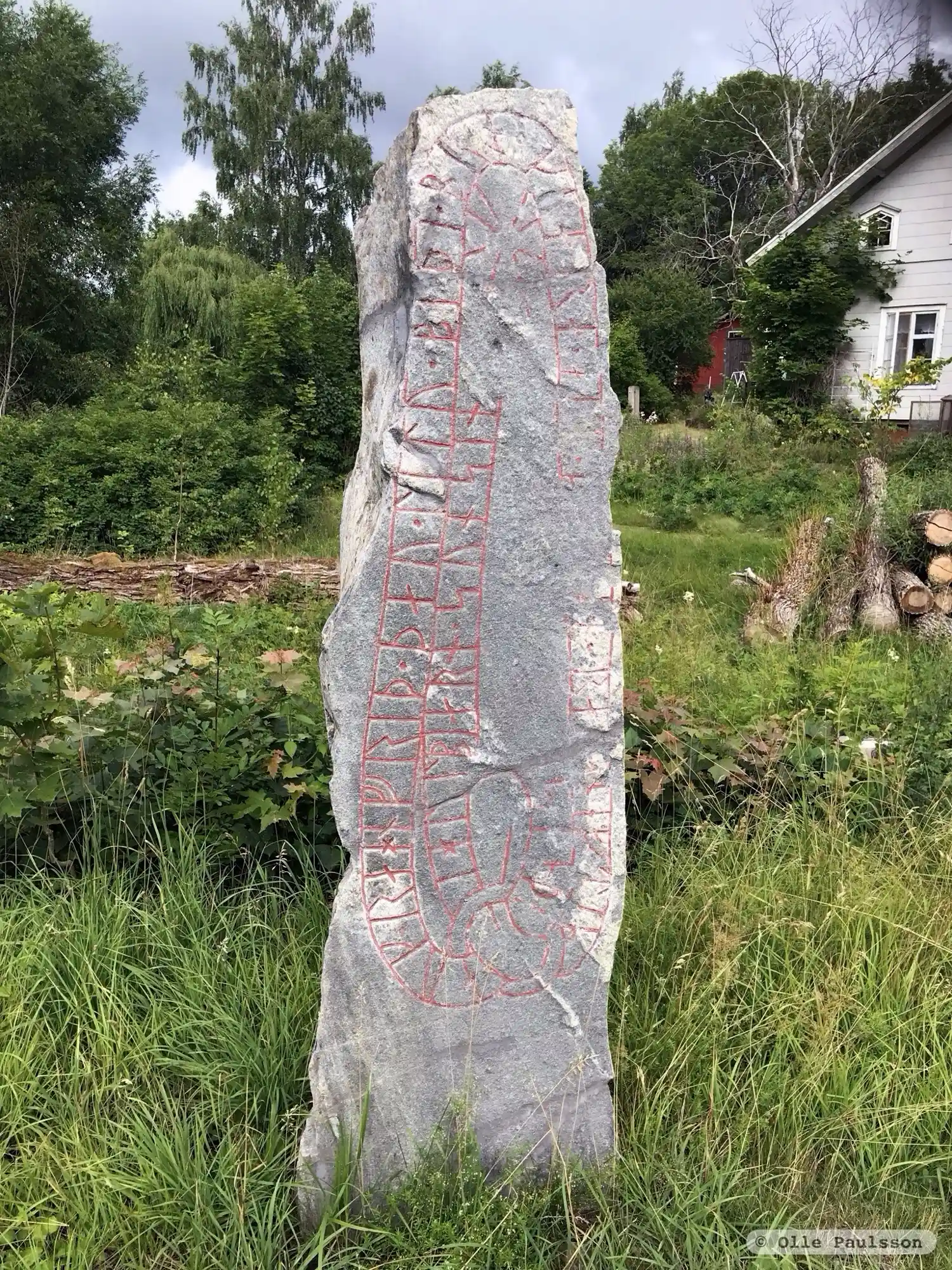
Photo: Olle Paulsson
Runic inscription
sloþi auk · rahnfriþ · þau · litu · biþi · bro · k(i)ara · a... · (s)...in · ra-(s)n · eftiR ihulbiarn · sun sin ·
Inscription
sloþi auk · rahnfriþ · þau · litu · biþi · bro · k(i)ara · a... · (s)...in · ra-(s)n · eftiR ihulbiarn · sun sin ·
Translation
Slóði and Ragnfríðr, they both had the bridge made and the stone raised in memory of Ígulbjôrn, their son.
Find the carving
Rune-stone Sö141, L1984:5900 in Ludgo parish, Nyköping municipality
Facts
| Monument number | L1984:5900 |
|---|---|
| Swedish National Heritage Board ID | Ludgo 59:1 |
| Status | Confirmed on location |
| Place | Visible above ground |
| Material | Granitee |
| Period | Viking age |
| Antiquarian assessment | Ancient monument |
| Damage status | Undamaged |
| County | Södermanland |
| Municipality | Nyköping |
| Parish | Ludgo |
| Coordinates | 58.926781, 17.099451 |
Sources
Most of the factual information in Runkartan comes from the Swedish National Heritage Board’s Fornsök data and from the Scandinavian Runic Text Database. The maps come from OpenStreetMap and Leaflet.js. The photographs were taken by the credited photographers.