Rune-stone Kungshållet, Sö106, L1985:9055 in Kjula parish, Eskilstuna municipality
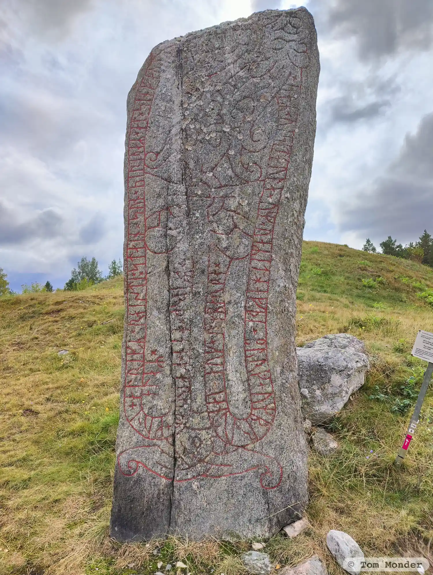
Photo: Tom Monder
Runic inscription
alrikR ¤ raisti ¤ stain × sun × siriþaR × at × sin faþur × sbiut ×× saR × uisitaula × um × uaRit : hafþi × burg × um brutna : i : auk × um barþa +× firþ × han × kar(s)aR + kuni + alaR ×
Inscription
alrikR ¤ raisti ¤ stain × sun × siriþaR × at × sin faþur × sbiut ×× saR × uisitaula × um × uaRit : hafþi × burg × um brutna : i : auk × um barþa +× firþ × han × kar(s)aR + kuni + alaR ×
Translation
Alríkr, Sigríðr's son, raised the stone in memory of his father Spjót, who had been in the west, broken down and fought in townships. He knew all the journey's fortresses.
Find the carving
Rune-stone Kungshållet, Sö106, L1985:9055 in Kjula parish, Eskilstuna municipality
Facts
| Monument number | L1985:9055 |
|---|---|
| Swedish National Heritage Board ID | Kjula 11:2 |
| Status | Confirmed on location |
| Place | Visible above ground |
| Material | Granitee |
| Period | Viking age |
| Antiquarian assessment | Ancient monument |
| Damage status | Undamaged |
| County | Södermanland |
| Municipality | Eskilstuna |
| Parish | Kjula |
| Coordinates | 59.3833685, 16.6720455 |
Sources
Most of the factual information in Runkartan comes from the Swedish National Heritage Board’s Fornsök data and from the Scandinavian Runic Text Database. The maps come from OpenStreetMap and Leaflet.js. The photographs were taken by the credited photographers.