Rune-stone Källstorpstenen eller Jordbergastenen, DR269, L1989:8364 in Källstorp parish, Trelleborg municipality
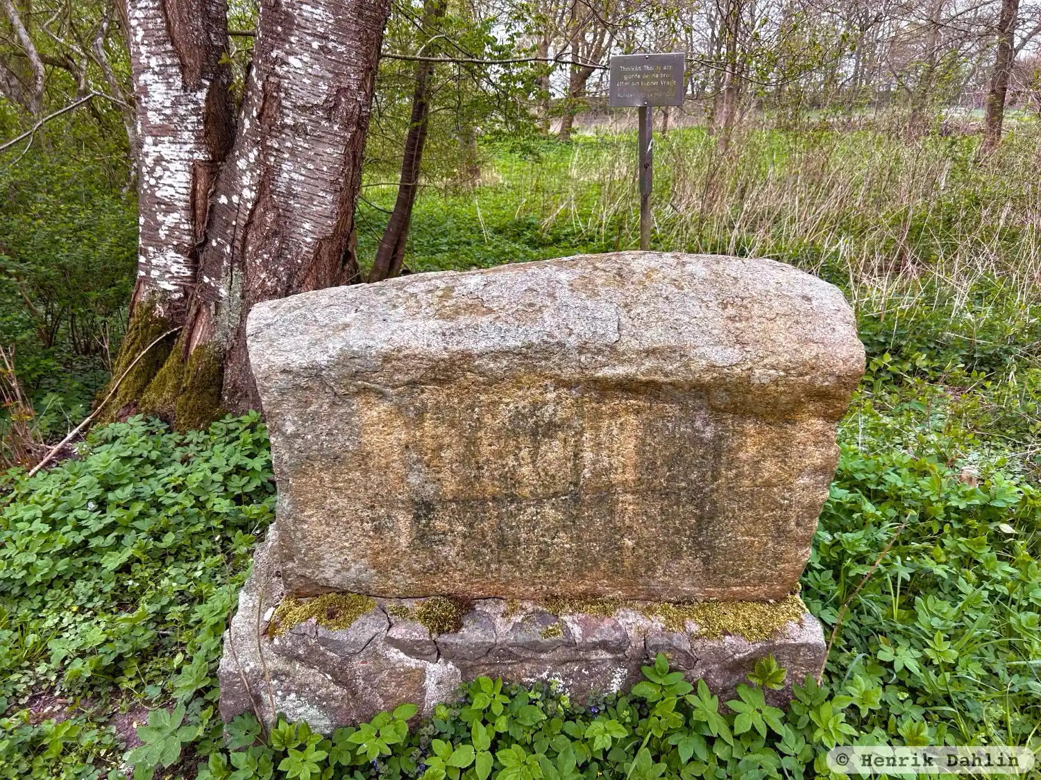
Photo: Henrik Dahlin
Runic inscription
÷ þurkil ÷ karþi ÷ þurþaR ÷ sun (÷) bru ÷ þisi ÷ aft ÷ uraka ÷ bruþur ÷ ¶ sin
Inscription
÷ þurkil ÷ karþi ÷ þurþaR ÷ sun (÷) bru ÷ þisi ÷ aft ÷ uraka ÷ bruþur ÷ ¶ sin
Translation
Þorkell, Þórðr's son, made this bridge in memory of Vragi/Rangi, his brother.
Find the carving
Rune-stone Källstorpstenen eller Jordbergastenen, DR269, L1989:8364 in Källstorp parish, Trelleborg municipality
Facts
| Monument number | L1989:8364 |
|---|---|
| Swedish National Heritage Board ID | Källstorp 2:1 |
| Status | Confirmed on location |
| Place | Visible above ground |
| Material | Granite |
| Period | Viking age |
| Antiquarian assessment | Ancient monument |
| Damage status | Undamaged |
| County | Skåne |
| Municipality | Trelleborg |
| Parish | Källstorp |
| Coordinates | 55.4133715, 13.4124195 |
Sources
Most of the factual information in Runkartan comes from the Swedish National Heritage Board’s Fornsök data and from the Scandinavian Runic Text Database. The maps come from OpenStreetMap and Leaflet.js. The photographs were taken by the credited photographers.