Runic rock inscription U102, L2015:4561 in Sollentuna parish, Sollentuna municipality
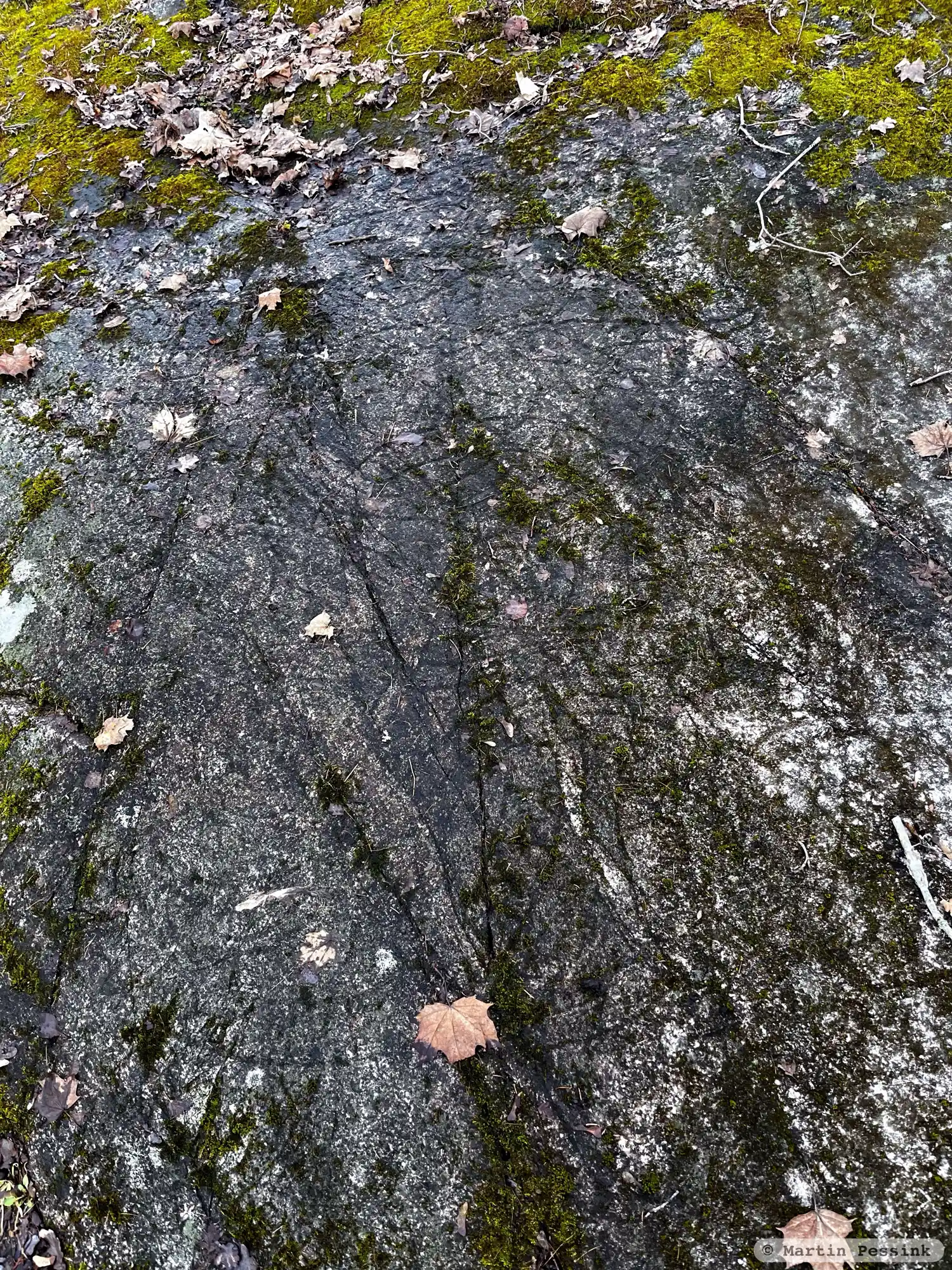
Photo: Martin Pessink
Runic inscription
kal|/kal|i| |lit/|l|it hkua heli þisa iftiR · suni sina toa · auk þau ikiþora · bR- (a)ina kiarþu mukit mirki furiR arkum mani
Inscription
kal|/kal|i| |lit/|l|it hkua heli þisa iftiR · suni sina toa · auk þau ikiþora · bR- (a)ina kiarþu mukit mirki furiR arkum mani
Translation
Kál/Kali had this rock-slab cut in memory of his two sons, and he and Ingiþóra made one bridge -- a great landmark for many(?) men.
Find the carving
Runic rock inscription U102, L2015:4561 in Sollentuna parish, Sollentuna municipality
Facts
| Monument number | L2015:4561 |
|---|---|
| Swedish National Heritage Board ID | Sollentuna 265:1 |
| Carver | Fot 2 (A); Ärnfast (A) |
| Status | Confirmed on location |
| Place | Visible above ground |
| Antiquarian assessment | Ancient monument |
| Damage status | Unknown |
| County | Stockholm |
| Municipality | Sollentuna |
| Parish | Sollentuna |
| Coordinates | 59.4545605, 17.901342 |
Sources
Most of the factual information in Runkartan comes from the Swedish National Heritage Board’s Fornsök data and from the Scandinavian Runic Text Database. The maps come from OpenStreetMap and Leaflet.js. The photographs were taken by the credited photographers.