Rune-stone Vs27, L2004:8783 in Kila parish, Sala municipality
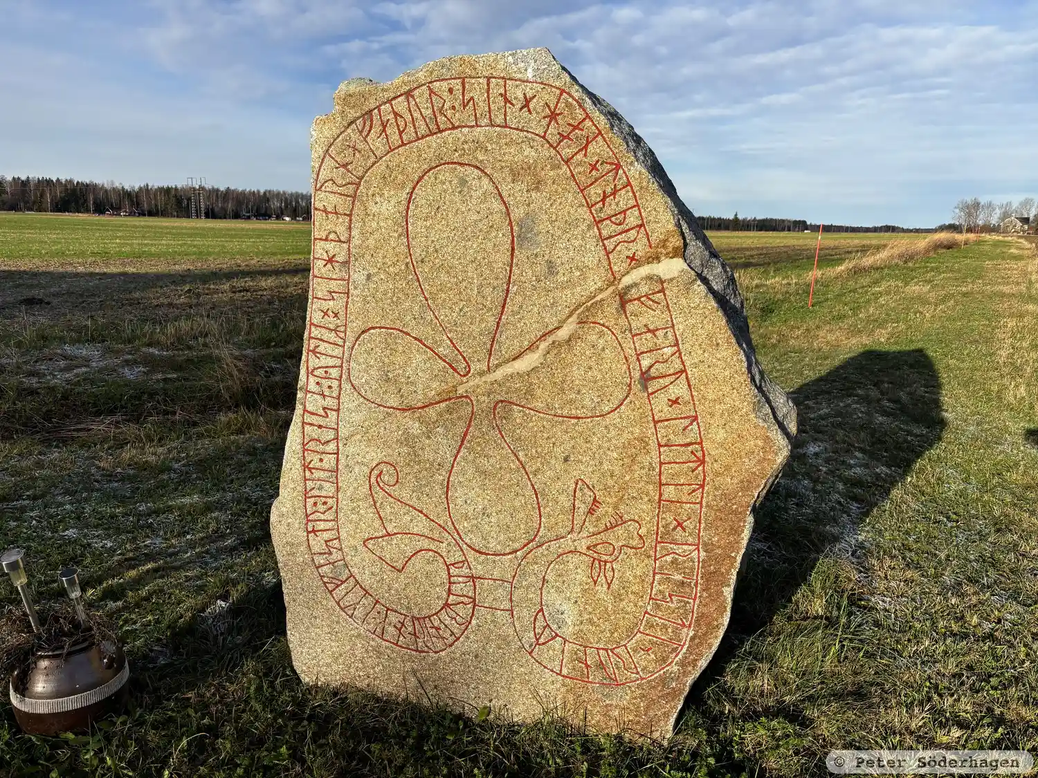
Photo: Peter Söderhagen
Runic inscription
þurbiorn ok : ikifastr : lit · resa : ytiR ¤ sihþorn × faþur : sin × hon × toþr × [i] faru × litli × risti × runiR ¶ · [...--keR · baþ : bru kera : r](u)(m)[Ri]
Inscription
þurbiorn ok : ikifastr : lit · resa : ytiR ¤ sihþorn × faþur : sin × hon × toþr × [i] faru × litli × risti × runiR ¶ · [...--keR · baþ : bru kera : r](u)(m)[Ri]
Translation
Þorbjôrn and Ingifastr had (the stone) raised in memory of Sigþorn, their father. He died on a voyage. Litli carved the runes. ...-geirr ordered a wider bridge to be made.
Find the carving
Rune-stone Vs27, L2004:8783 in Kila parish, Sala municipality
Facts
| Monument number | L2004:8783 |
|---|---|
| Swedish National Heritage Board ID | Kila 1:1 |
| Carver | Litle (S) |
| Status | Confirmed on location |
| Place | Visible above ground |
| Material | Granite with yellowish surface layer |
| Antiquarian assessment | Ancient monument |
| Damage status | Damage |
| County | Västmanland |
| Municipality | Sala |
| Parish | Kila |
| Coordinates | 59.8520015, 16.533579 |
Sources
Most of the factual information in Runkartan comes from the Swedish National Heritage Board’s Fornsök data and from the Scandinavian Runic Text Database. The maps come from OpenStreetMap and Leaflet.js. The photographs were taken by the credited photographers.