Rune-stone Vs22, L2004:7271 in Haraker parish, Västerås municipality
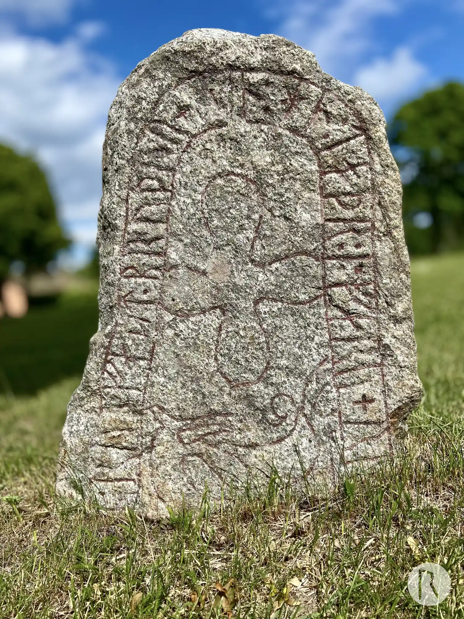
Photo: Niklas Vackerdag
Runic inscription
... + ytR : runfast · bruþur + s^in : hn : toþr : i : faru + runo : ... (t)rka
Inscription
... + ytR : runfast · bruþur + s^in : hn : toþr : i : faru + runo : ... (t)rka
Translation
... in memory of Rúnfastr, his brother. He died on a voyage. Runa ... / He died on Runi's voyage ... of valiant men.
Find the carving
Rune-stone Vs22, L2004:7271 in Haraker parish, Västerås municipality
Facts
| Monument number | L2004:7271 |
|---|---|
| Swedish National Heritage Board ID | Haraker 25:1 |
| Carver | Litle (A) |
| Status | Confirmed on location |
| Place | Visible above ground |
| Material | Granite |
| Antiquarian assessment | Ancient monument |
| Damage status | Damage |
| County | Västmanland |
| Municipality | Västerås |
| Parish | Haraker |
| Coordinates | 59.778195, 16.379623 |
Sources
Most of the factual information in Runkartan comes from the Swedish National Heritage Board’s Fornsök data and from the Scandinavian Runic Text Database. The maps come from OpenStreetMap and Leaflet.js. The photographs were taken by the credited photographers.