Rune-stone VgNOR1997;27, L1960:5245 in Hol parish, Vårgårda municipality
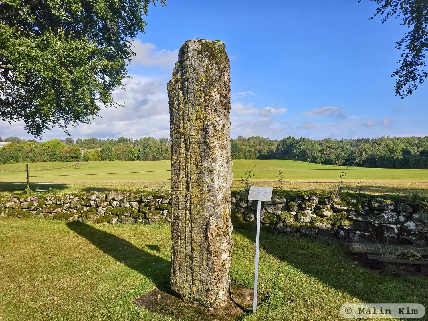
Photo: Malin Kim
Runic inscription
: ulfr : auk : asur : risþu : stin : þosi : eftiR : oslak : harþa : kuþan : þikn : faþur : sin : hrþa : frunan
Inscription
: ulfr : auk : asur : risþu : stin : þosi : eftiR : oslak : harþa : kuþan : þikn : faþur : sin : hrþa : frunan
Translation
Ulfr and Ôzurr raised this stone in memory of Áslakr, a very good Þegn, their father, very brave and valiant.
Find the carving
Rune-stone VgNOR1997;27, L1960:5245 in Hol parish, Vårgårda municipality
Facts
| Monument number | L1960:5245 |
|---|---|
| Swedish National Heritage Board ID | Hol 151 |
| Status | Confirmed on location |
| Place | Visible above ground |
| Antiquarian assessment | Ancient monument |
| Damage status | Damage |
| County | Västra Götaland |
| Municipality | Vårgårda |
| Parish | Hol |
| Coordinates | 57.9750255, 12.665213 |
Sources
Most of the factual information in Runkartan comes from the Swedish National Heritage Board’s Fornsök data and from the Scandinavian Runic Text Database. The maps come from OpenStreetMap and Leaflet.js. The photographs were taken by the credited photographers.